Periodically updated JMA images show Owakudani's volcanic landscape and visibility. This is not continuous video, and fog or steam may obscure the view. Check official volcanic alerts and access restrictions before visiting.
Image update intervals and capture times depend on the operator. Check the official page for current broadcast status.
How to view this camera
What the camera shows
Owakudani volcanic landscape
Viewing format
View at the official source
Open the official camera page to access the operator’s video or images. Viewing options are provided on that page.
When to choose this view
Use this official view when you want to check the volcanic scenery and sky at Owakudani. It is a different highland area from Hakone-Yumoto, so do not use one view to judge conditions across all of Hakone.
What this view cannot tell you
Access around a volcano can change independently of the weather. Before visiting or using the ropeway, check official volcano and operating notices from the weather agency, Hakone facilities and transport operators.
If no view is available, check the source page for operating notices. A missing preview here does not necessarily mean the camera is offline.
“Connection last checked” records a link check, not an image capture time or confirmation of a live broadcast.
The camera only covers its field of view. Check the relevant official notices for weather, transport and access restrictions. Source information
During an earthquake, severe rain, typhoon or other emergency, use this view only as a reference. Follow official weather, disaster and transport alerts, plus instructions on site, when deciding whether to evacuate or travel.
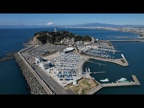
Riviera, the operator of Enoshima Yacht Harbor, provides this official harbor and sea view. Check the local atmosphere before an Enoshima walk. The marker approximates the harbor facilities rather than placing the camera on the water it overlooks.
Minamiashigara City and Hakone Tourist Association link to this official camera at Kintaro Chaya on Mount Kintoki. Open the original page for summit-area mountain scenery. The marker approximates the teahouse. Commercial footage reuse requires prior consultation, so this site provides an original-page link only.
A Hakone Tourist Association camera covering the road and pedestrian approach near Yumoto Station, a gateway to the hot-spring area. It does not show bathing areas or the entire onsen town. The marker approximates the area around the tourism products museum; the exact mounting point is unverified.
Kamakura City links to these periodic, privacy-blurred images of Koshigoe Rakko Park near Kamakurakokomae. The public feed continues after the city and SKIDAY tourism pilot, helping visitors check crowding around the designated photography area. Check the capture time on the original site. This is not continuous video of the entire railway crossing or station platform; the marker approximates the park vicinity.
A Dankazura camera linked by Toshimaya, a Kamakura souvenir shop, on its official website. It shows the approach, second torii and tree-lined surroundings, not the shrine interior. The marker uses the surrounding-area reference from the official main-store map, not an exact building or camera mounting point.


 YouTube · Not a live image