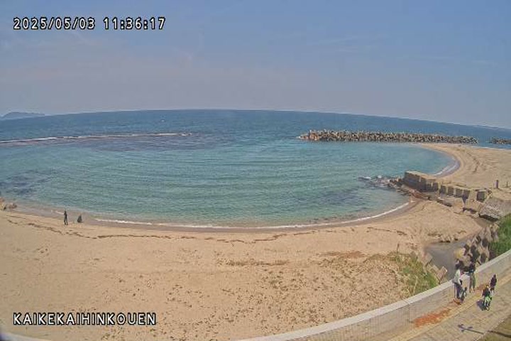
Coastal observation images provided by the Ministry of Land, Infrastructure, Transport and Tourism's Hino River Office at Kaike Seaside Park. Check the seafront weather while planning a walk during a Kaike Onsen visit. This is not a camera inside a bath or overlooking the hot-spring streets. Darkness, rain and water on the lens may obscure the view; check the timestamp on the original image. Do not use it to determine swimming safety, and stay away from the coast during high waves.
Image update intervals and capture times depend on the operator. Check the official page for current broadcast status.
How to view this camera
What the camera shows
The coast and sea beside Kaike Onsen Seaside Park
Viewing format
Official page · still preview
Open the official camera page for the operator’s video or images. The preview here is a still image, not a continuously playing video. Check capture times when viewing still images at the source.
When to choose this view
Use the seaside-park observation image for the coastal portion of a Kaike Onsen trip rather than the onsen streets.
What this view cannot tell you
Drops on the lens can blur the scene. The image cannot establish swimming safety or bath operations.
An unchanged preview does not rule out a working video at the source. Open the official page to check. If its still image has not changed either, check the timestamp and operating notices.
“Connection last checked” records a link check, not an image capture time or confirmation of a live broadcast.
The camera only covers its field of view. Check the relevant official notices for weather, transport and access restrictions. Source information
During an earthquake, severe rain, typhoon or other emergency, use this view only as a reference. Follow official weather, disaster and transport alerts, plus instructions on site, when deciding whether to evacuate or travel.
See Mount Karasugasen and the surrounding highlands from Kagamiganaru in Daisen. Open the Ministry of the Environment's camera page to view its images.
Daisen Tourism Organization provides this camera from its tourist information center. Check the mountain area's weather and seasonal scenery before a visit. The marker shows the approximate information-center location, not a verified camera mount. The YouTube preview does not guarantee the current scene.
Tottori Prefecture links camera 1 on its Sand Dunes Navi service. Photographs looking from the eastern side toward Umanose, the oasis area and the sea refresh about once a minute. This is an updating photo camera, not video. Select the Tottori Sand Dunes Navi link on the official information page to view the original HTTP-only viewer. We do not copy or relay its images. The marker is an approximate visitor-center area reference, not a verified mount.
An official NKT camera overlooking Yonago Station and the Gaina Road pedestrian passage, a gateway for trips around the Sanin region. The marker uses the approximate location of Yonago Washington Hotel Plaza, identified as the filming facility, rather than the exact camera mount.

 Periodically updated image · 12/09, 20:00 JST
