
Sapporo Station platform area
Sapporo Station's platform canopy and tracks
- Source
- Sapporo Television Broadcasting (STV)
- Format
- Official camera page
北海道
For central Sapporo, open the station or Odori Park camera. Bihoro Pass looks over Lake Kussharo much farther away; a clear day in Sapporo says little about conditions at the lake.
Sapporo and Otaru work well together. Biei and eastern Hokkaido are much farther away, so give them their own travel days instead of treating them as quick stops from Sapporo.
For snow, choose between a city stay and a mountain trip; they need different clothing and transport plans. Summer flower fields and lakes call for a separate check of bloom reports and access.
Soup curry and grilled lamb are two different Sapporo meals; coastal towns open up more seafood choices. Skip lamb if its flavour is not for you.
Sapporo Station's platform canopy and tracks
Odori Park and the surrounding cityscape in Sapporo
The streets and sky around Otaru Canal
The observatory area beside Mount Moiwa's summit elevation sign
Central Sapporo and Odori Park
Hakodate cityscape and surrounding sea
 External preview restricted · check the official source
Hokkaido
JR札幌駅(STV)
STV’s Sapporo Station camera shows the platform canopy and tracks. The angle can change, and JR Tower was not visible in the view we checked.
Sapporo Television Broadcasting (STV)
Open official cameraExternal preview restricted · check the official sourceHokkaido
札幌大通公園(STV)
STV’s camera views Odori Park and central Sapporo from a building south of the park. Its direction can change; open STV’s page for the current image and separate live-video link.
Sapporo Television Broadcasting (STV)
Open official cameraExternal preview restricted · check the official sourceHokkaido
小樽運河 ホテルノルド小樽(STV)
STV's camera at Hotel Nord Otaru shows the streets and sky around Otaru Canal. Take a look at the canal-side setting before a walk.
Sapporo Television Broadcasting (STV)
Open official camera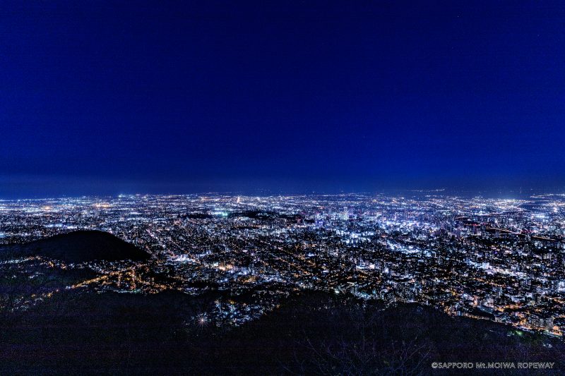 Not live video
Hokkaido
もいわ山山頂 標高看板前
The official still image, updated every ten minutes, shows the area around Mount Moiwa’s summit elevation sign. The introductory image on this page is not a current view.
Sapporo Development Corporation — Mount Moiwa Ropeway
Open official cameraNo on-site preview · check the official sourceHokkaido
大通ビッセ屋上からの札幌
HBC’s camera looks out over Odori Park and central Sapporo from the rooftop of Odori Bisse. The view can change for broadcast coverage, and image updates may pause.
Hokkaido Broadcasting (HBC)
Open official cameraNo on-site preview · check the official sourceHokkaido
函館山からの函館市街 HBC
Look over Hakodate and the sea on either side from HBC's Mount Hakodate camera. It offers city views by day and lights at night, though the direction and image updates may change.
Hokkaido Broadcasting (HBC)
Open official cameraExternal preview restricted · check the official sourceHokkaido
大倉山ジャンプ競技場 山頂展望台
Look across Sapporo from STV's camera at the Okurayama Ski Jump Stadium summit observatory. This seasonal camera may pause or change direction, including for winter anti-icing measures.
Sapporo Television Broadcasting (STV)
Open official camera YouTube · Video thumbnail · check live status at source
Hokkaido
新千歳空港ターミナル STV
See the sky and aircraft activity at New Chitose Airport through STV's camera. The broadcaster may switch to news coverage or pause the feed.
Sapporo Television Broadcasting
Watch on YouTubeExternal preview restricted · check the official sourceHokkaido
旭川市街 STV
See Asahikawa's cityscape through STV's official camera. In winter, the camera may change direction to prevent freezing.
Sapporo Television Broadcasting
Open official cameraExternal preview restricted · check the official sourceHokkaido
釧路 幣舞橋 STV
Look toward the Kushiro River and Nusamai Bridge through STV's camera. The official page gives different installation details in Japanese and English, so the map uses an approximate reference near the bridge.
Sapporo Television Broadcasting
Open official cameraHokkaido
葛登支岬灯台
This official Japan Coast Guard image shows the coast and Tsugaru Strait horizon from Kattoshi Cape Lighthouse in Hokuto.
Japan Coast Guard
Open official cameraNo on-site preview · check the official sourceHokkaido
小樽天狗山 屋上展望台
The ropeway shares views over Otaru from the summit observation area. Select the current broadcast on its official channel; the spring view may include the Tengu cherry tree.
Otaru Tenguyama Ropeway
Open YouTube channelNo on-site preview · check the official sourceHokkaido
有珠山ロープウェイ 有珠山頂駅
Usuzan Ropeway publishes updated photographs from its summit station. Check mountain visibility here, and consult the operator separately for ropeway service.
Wakasa Resort, Usuzan Ropeway
Open official cameraExternal preview restricted · check the official sourceHokkaido
ジェットコースターの路
Kamifurano publishes photographs of its scenic Roller Coaster Road and surrounding hills at roughly five-minute intervals. Click the source photograph to see a sequence from about the preceding hour.
Town of Kamifurano
Open official cameraExternal preview restricted · check the official sourceHokkaido
千望峠
Kamifurano's Senbo Pass camera shows the hills and the view towards the mountain range in photographs taken roughly five minutes apart.
Town of Kamifurano
Open official cameraExternal preview restricted · check the official sourceHokkaido
日の出公園展望台
Kamifurano's Hinode Park photographs show the lavender hillside and town from the viewpoint, updating roughly every five minutes. On the source page, click the photograph for a sequence from about the preceding hour.
Town of Kamifurano
Open official cameraExternal preview restricted · check the official sourceHokkaido
十勝岳温泉 東側・西側
Kamifurano provides east- and west-facing photographs around Tokachidake Onsen at roughly five-minute intervals. Choose the direction on the official page and click the photograph for a sequence from about the preceding hour.
Town of Kamifurano
Open official cameraNo on-site preview · check the official sourceHokkaido
登別地獄谷・気象庁倶多楽カメラ
The Japan Meteorological Agency posts periodically updated observation photos of Noboribetsu's Jigokudani Valley. The camera shows volcanic terrain and steam beside the hot-spring town; steam, clouds and darkness may limit visibility.
Japan Meteorological Agency
Open official cameraNo on-site preview · check the official sourceHokkaido
ルスツリゾート・ウエストMt.ライブカメラ
Rusutsu Resort posts regularly updated photos looking toward the resort, Lake Toya and Mount Yotei from West Mountain. Choose a view on the official page.
Rusutsu Resort
Open official cameraNo on-site preview · check the official sourceHokkaido
羅臼国後展望塔・海の眺望
This rooftop camera looks out to sea towards Kunashir Island from an observation tower above Rausu. The island may disappear from view in cloud or darkness.
Northern Territories Issue Association
Watch on YouTube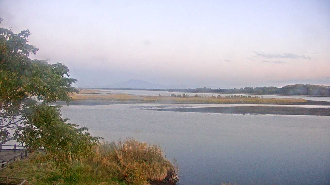 Periodically updated image · 08/10, 17:00 JST
Hokkaido
濤沸湖と斜里岳
This camera looks across Lake Tofutsu toward Mount Shari from the Waterfowl and Wetland Center. The lake and wetland share the frame, with the mountain farther back.
Ministry of the Environment Biodiversity Center
Open official camera Periodically updated image · 09/10, 20:00 JST
Hokkaido
美幌峠からみた屈斜路湖
This periodically refreshed image looks down on Lake Kussharo from the Gurutto Panorama roadside station at Bihoro Pass. The lake, mist and surrounding mountains fill the view.
Ministry of the Environment Biodiversity Center
Open official camera Periodically updated image · 09/10, 20:00 JST
Hokkaido
釧路湿原のタンチョウ
This camera looks over the fields at Tsurui Ito Crane Sanctuary, where red-crowned cranes gather in winter. Whether they appear in the image depends on the season and time of day.
Ministry of the Environment Biodiversity Center
Open official camera Periodically updated image · 04/10, 13:15 JST
Hokkaido
サロベツ湿原センターからみたサロベツ湿原
The Sarobetsu Wetland Center camera looks out across the marsh. The wetland’s colors change with the seasons, with the sky above in view as well.
Ministry of the Environment Biodiversity Center
Open official camera Periodically updated image · 09/10, 20:00 JST
Hokkaido
幌延ビジターセンターからみたサロベツ湿原
From Horonobe Visitor Center, the camera looks over Naganuma and the surrounding Sarobetsu wetland. The landscape changes with the seasons.
Ministry of the Environment Biodiversity Center
Open official camera Periodically updated image · 09/10, 20:00 JST
Hokkaido
クッチャロ湖のハクチョウ
This view looks over Lake Kutcharo from the Waterfowl Observatory in Hamatonbetsu. Migrating birds stop here in spring and autumn, though they may not be in the frame.
Ministry of the Environment Biodiversity Center
Open official cameraHokkaido
宗谷岬灯台
The Japan Coast Guard camera at Cape Soya Lighthouse looks toward the sea and sky at Hokkaido’s northern tip. Open the source to see the horizon and coastline around the cape.
Japan Coast Guard
Open official cameraHokkaido
元地灯台
This camera looks along the southern coast of Rebun Island from Motochi Lighthouse, near the walking route to Momoiwa Observatory.
Japan Coast Guard
Open official cameraHokkaido
チキウ岬灯台
From Cape Chikyu Lighthouse in Muroran, the camera looks over the Pacific. The cliffs and horizon are part of the view.
Japan Coast Guard
Open official cameraHokkaido
襟裳岬灯台
From Cape Erimo Lighthouse, the camera shows the sea and sky around the cape. Check the view before a drive along the Hidaka coast.
Japan Coast Guard
Open official cameraHokkaido
鴎島灯台
This lighthouse camera looks over the sea around Kamome Island in Esashi. Open the official source before planning a coastal walk or evening visit.
Japan Coast Guard
Open official cameraHokkaido
日和山灯台
From Hiyoriyama Lighthouse in Otaru’s Shukutsu district, the camera looks out over the sea and sky. You can see the coast around the lighthouse before exploring the area.
Japan Coast Guard
Open official cameraHokkaido
増毛灯台
The Mashike Lighthouse camera looks out over the coast near the old port town. It shows the sea rather than the town streets.
Japan Coast Guard
Open official cameraHokkaido
サロマ湖口灯台
This camera shows where Lake Saroma meets the Sea of Okhotsk. The view takes in the surrounding sea and sky at the lake’s entrance.
Japan Coast Guard
Open official cameraHokkaido
納沙布岬灯台
The Cape Nosappu Lighthouse camera in Nemuro looks out over the sea. Visibility changes with the weather and time of day, even at this sunrise spot.
Japan Coast Guard
Open official cameraNo on-site preview · check the official sourceHokkaido
第一展望台からみた摩周湖
This camera shows Lake Mashu from Teshikaga Town’s First Observatory. Depending on the mist, more or less of the lake may be visible.
Ministry of the Environment Biodiversity Center
Open official cameraNo on-site preview · check the official sourceHokkaido
大雪山旭岳
This is Mount Asahidake from Sugatami Station, the ropeway’s upper station. Depending on the season, you may see lingering snow or autumn color on the mountain.
Ministry of the Environment Biodiversity Center
Open official cameraNo on-site preview · check the official sourceHokkaido
ニセコビュープラザ 羊蹄山
The camera at Niseko View Plaza looks toward Mount Yotei and the surrounding sky. The mountain’s outline and seasonal changes are in view.
Niseko Resort Tourist Association
Watch on YouTubeNo on-site preview · check the official sourceHokkaido
ニセコアンヌプリ国際スキー場 山麓
This camera shows the base area at Niseko Annupuri International Ski Area. It covers the winter snowscape and the area around the sightseeing gondola in summer.
Chuo Bus Niseko Kanko Kaihatsu
Watch on YouTubeNo on-site preview · check the official sourceHokkaido
ニセコHANAZONO HANAZONO308
From Hanazono 308, the camera looks over the base area in Niseko. The resort’s view includes the surrounding sky and winter snow.
Niseko Hanazono Resort
Watch on YouTubeNo on-site preview · check the official sourceHokkaido
キロロ マウンテンセンター前
The camera at Kiroro’s Mountain Center looks over the ski area’s base, with the surrounding sky and winter scenery in view.
Kiroro Resort
Watch on YouTubeNo on-site preview · check the official sourceHokkaido
札幌国際スキー場 山麓
This camera shows the base area at Sapporo Kokusai Ski Resort. Depending on the season, you’ll see winter snow or the forest around the autumn sightseeing gondola.
Sapporo Resort Development Corporation
Watch on YouTubeNo on-site preview · check the official sourceHokkaido
函館山 山頂展望台
From Hakodate’s summit observatory, this camera looks down on the city with water on both sides. The ropeway operator’s official camera shows the daytime view and nightscape.
Mount Hakodate Ropeway
Watch on YouTubeExternal preview restricted · check the official sourceHokkaido
札幌 STV本社
A rooftop camera at STV's Sapporo headquarters looks out over the city. Its direction may change for broadcasts or weather, so check the official page to see which view is currently shown.
Sapporo Television Broadcasting (STV)
Open official cameraCamera guide updated: