
Tokyo Bay from Kannonzaki
Tokyo Bay, Uraga Channel and the opposite coast from Kannonzaki
- Source
- Japan Coast Guard
- Format
- Official page · still preview
神奈川県
There are separate views of central Yokohama, Kamakura’s Dankazura approach, Enoshima Harbour and Hakone-Yumoto Station. For Kamakura, look at Dankazura or Koshigoe; for a Hakone onsen trip, check the station area there.
Yokohama’s harbour, Kamakura’s temples and coast, and Hakone’s onsen each deserve time. Trying all three on a day trip from Tokyo would mean long stretches on trains; choose one area to explore properly.
Kamakura’s approach is a spring walk; Yokohama Harbour works for an evening skyline. A Hakone trip for Fuji views needs its own cloud and transport check.
Yokohama is known for shumai dumplings and rich Iekei ramen. If you are heading straight to Hakone, check whether you actually have time for a meal in Yokohama before picking a restaurant.
Tokyo Bay, Uraga Channel and the opposite coast from Kannonzaki
Enoshima’s yacht harbor and surrounding sea
Yokohama’s cityscape and sky from the broadcaster’s rooftop
Mountain scenery from the summit’s Kintaro Chaya
Crowding around the park and photography area near Kamakurakokomae
Visitor approach near Yumoto Station
Kanagawa
観音埼レーダー施設
This official Japan Coast Guard image looks across Tokyo Bay and the Uraga Channel from the Kannonzaki radar facility. Before visiting Kannonzaki Park and lighthouse, it can show visibility toward the Boso Peninsula and passing ships.
Japan Coast Guard
Open official camera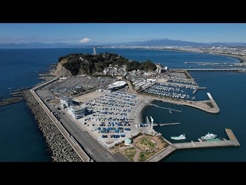 YouTube · Video thumbnail · check live status at source
Kanagawa
江の島ヨットハーバー 湘南港
Riviera, the operator of Enoshima Yacht Harbor, provides this official harbor and sea view. Check the local atmosphere before an Enoshima walk.
Riviera / Enoshima Yacht Harbor
Watch on YouTube YouTube · Video thumbnail · check live status at source
Kanagawa
横浜定点ライブカメラ テレビ神奈川屋上
Television Kanagawa’s official broadcast shows Yokohama’s cityscape and sky from its rooftop. The approximate location is the Yokohama Media and Business Center in Otamachi.
Television Kanagawa / tvk
Watch on YouTube External preview restricted · check the official source
Kanagawa
金時山山頂 金太郎茶屋
Minamiashigara City and Hakone Tourist Association link to this official camera at Kintaro Chaya on Mount Kintoki. Open the original page for summit-area mountain scenery.
Minamiashigara City
Open official cameraNo on-site preview · check the official sourceKanagawa
鎌倉高校前・腰越ラッコ公園
Kamakura City publishes periodically updated, privacy-blurred images of Koshigoe Rakko Park near Kamakurakokomae. Check the source capture time when looking at crowding in the photography area.
Kamakura City / SKIDAY
Open official cameraNo on-site preview · check the official sourceKanagawa
箱根湯本駅周辺
The Hakone Tourist Association's Yumoto camera shows the street near the station, with directions labelled towards Miyanoshita and towards Odawara and Tokyo.
Hakone Tourist Association
Open YouTube channelNo on-site preview · check the official sourceKanagawa
豊島屋 段葛
Toshimaya's official Dankazura camera shows the approach, the second torii and its tree-lined path rather than the shrine grounds. The map pin is a reference near Toshimaya's main store, not a verified camera position.
Kamakura Toshimaya
Watch on YouTubeNo on-site preview · check the official sourceKanagawa
箱根山 大涌谷
Periodically updated JMA images show Owakudani's volcanic landscape and visibility. This is not continuous video, and fog or steam may obscure the view.
Japan Meteorological Agency
Open official cameraKanagawa
剱埼灯台
From the lighthouse on eastern Miura, the camera looks over Cape Tsurugisaki and the Uraga Channel. Passing vessels may appear, but the image is not a ferry timetable.
Japan Coast Guard
Open official cameraCamera guide updated: