Mount Fuji from Lake Tanuki
Lake Tanuki shore and the direction of Mount Fuji
- Source
- Ministry of the Environment Biodiversity Center
- Format
- Official page · still preview
 JapanLiveNowLIVE한국어
田貫湖畔からみた富士山
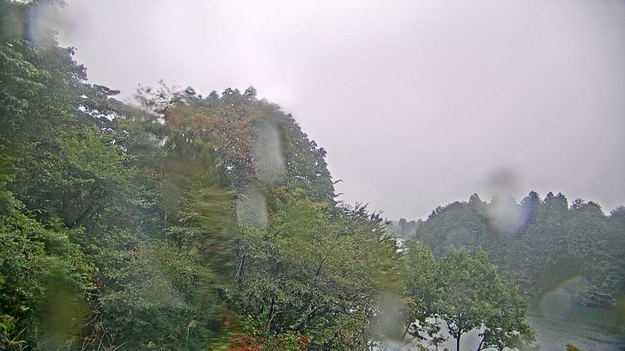 Periodically updated image · 26/09, 14:00 JST
This official Ministry of the Environment image combines Lake Tanuki with the direction of Mount Fuji. It offers a Shizuoka-side lakeside perspective distinct from Lake Kawaguchiko and Lake Yamanaka. Fuji visibility depends on cloud and capture time; check separate official information for campsite access and road conditions.
Shizuoka · Forecast for the reference city; conditions at the camera may differ.
Loading weather...
Weather data is unavailable or delayed, so this viewing reference cannot be confirmed.
The reference-city forecast may differ from conditions at Mount Fuji. Check the source camera to see whether the mountain is visible.
Choose this lakeside image for Fuji across Lake Tanuki, a Shizuoka-side composition distinct from Kawaguchiko and Yamanakako.
Official page · still preview. This is a still-image preview, not continuous video. Check the official page for its capture time and any video feed.
A clear mountain does not establish campsite availability or lakeside road conditions. Check the capture date and facility notices.
If the image has not changed, check its source timestamp or service notice. This site’s preview refresh alone does not establish whether the camera is operating.
Operator and source information ↗
Camera travel guide updated:
Report an error or ended video for this camera · Our editorial standards
| Camera | What it shows | Open source |
|---|---|---|
| Mount Fuji from Lake Tanuki | Lake Tanuki shore and the direction of Mount Fuji | Official page · still preview ↗ |
| Mount Fuji from Kawaguchiko | Mount Fuji from the grounds of Kawaguchiko Lakeside Hotel | Official page · still preview ↗ |
| Oishi Park on Lake Kawaguchi | Lake Kawaguchi and the view toward Mount Fuji from Oishi Park | Official camera page ↗ |
The pin marks the camera facility or a documented reference point. Some cameras are on hotel roofs or broadcast buildings that visitors cannot enter. Check the entrance to the place you actually plan to visit.
The closest station by coordinates is Kaioshima Station, 9.3 km from the camera reference point in a straight line. This is not a verified walking route or recommended access station. Check the visitor destination and its official access information.
Lake Tanuki shore and the direction of Mount Fuji
Mount Fuji from the grounds of Kawaguchiko Lakeside Hotel
Lake Kawaguchi and the view toward Mount Fuji from Oishi Park
Mount Fuji from the Panoramic Ropeway's upper observatory
Lake Kawaguchi and Mount Fuji from Kogetsu on the northern shore
Lake Kawaguchi and Mount Fuji from THE KUKUNA on the eastern shore
Camera facility location · 35.34069, 138.55323
The map also shows rail lines serving Kaioshima Station. The distance above is a straight line, not a walking time. Check the actual entrance and route below.
The closest station in a straight line may not be the easiest way in. The route also ends at the camera reference point, so change it to the place you actually plan to visit. Check buses, journey time and first or last trains in the route results.
Distances are straight lines between camera reference points, not actual journey distances or times.
 YouTube · Not live video
Yamanashi
身延山久遠寺 境内
Kuonji's official camera, installed at Shakaden Shinnouhaido, shows the precinct around Soshido and the side of the main hall, including seasonal weeping cherry blossoms.
About 12.5 km · straight line
Minobusan Kuonji Temple
Watch on YouTube No on-site preview · check the official source
Shizuoka
静岡県富士山世界遺産センター
See Mount Fuji from the roof of Shizuoka's Mount Fuji World Heritage Centre. The source updates still images about every ten minutes, rather than providing continuous video; check the capture time.
About 14.0 km · straight line
Mt. Fuji World Heritage Centre, Shizuoka
Open official cameraNo on-site preview · check the official sourceShizuoka
富士宮市役所 富士山
See Mount Fuji in still images from Fujinomiya City Hall. The city's official page lets you compare the latest capture with earlier images from the same day.
About 14.6 km · straight line
Fujinomiya City
Open official cameraNo on-site preview · check the official sourceYamanashi
本栖湖・富士山ライブカメラ(YBS山梨放送)
Minobu Town links to YBS's Lake Motosu and Mount Fuji camera near the Nakanokura Pass viewpoint northwest of the lake. Weather or darkness may hide the mountain or lake.
About 15.1 km · straight line
YBS Yamanashi Broadcasting System
Watch on YouTubeExternal preview restricted · check the official sourceYamanashi
精進湖・富士山
Kawaguchiko Cable TV's Lake Shojiko camera is linked by Fujikawaguchiko Town. The official page shows a still image of the lake and Mount Fuji, refreshed about every five minutes.
About 17.3 km · straight line
Kawaguchiko Cable TV
Open official camera YouTube · Not live video
Yamanashi
富士山五合目受付窓口付近(吉田ルート)
See the reception area at the Fifth Station General Management Center on Mount Fuji's Yoshida Route. Yamanashi Prefecture operates this seasonal camera during the climbing season; check the source for stream availability.
About 17.4 km · straight line
Yamanashi Prefecture
Watch on YouTube