Nara
Nosegawa Sea of Clouds View
野迫川村 雲海景勝地
This official camera looks out from Nosegawa’s sea-of-clouds viewpoint. The clouds depend on the weather, and fog or darkness can limit the view.
Komadori Cable
Open official cameraChoose a place to see what its camera covers, whether it offers video or still images, and where to find the official source.
Nara
野迫川村 雲海景勝地
This official camera looks out from Nosegawa’s sea-of-clouds viewpoint. The clouds depend on the weather, and fog or darkness can limit the view.
Komadori Cable
Open official cameraNara
十津川村 谷瀬の吊り橋
Komadori Cable’s official camera shows the area around Tanize Suspension Bridge. Preview the setting and check local notices separately for access restrictions.
Komadori Cable
Open official cameraNara
上北山村 小橡瀧川寺
The official camera covers the area around the temple in Kotochi, Kamikitayama. It shows the mountain village setting, not the temple interior.
Komadori Cable
Open official cameraNara
下北山村 上池原スポーツ公園
The official camera covers the area around Kamiikehara Sports Park in Shimokitayama. Check the local weather and scenery before outdoor activities.
Komadori Cable
Open official cameraNara
奈良公園内道路
Nara Prefecture’s updating road snapshots help with a visit to Nara Park and Todaiji. This is an approach-road view, not a deer camera or the temple interior.
Nara Prefecture
Open official cameraSaitama
秩父ミューズパーク 旅立ちの丘 雲海
Chichibu City publishes photos from Tabidachi no Oka in Muse Park about every five minutes. Cloud formations vary; check the capture time on the official page.
Chichibu City
Open official cameraSaitama
長瀞駅前
The Nagatoro Tourism Association publishes updating photos of Nagatoro Station Square. Check the station approach and nearby cherry trees and the capture time on the official page.
Nagatoro Tourism Association
Open official cameraSaitama
長瀞岩畳
The Nagatoro Tourism Association publishes updating photos of Nagatoro Iwadatami Rocks. Check the Iwadatami rock formations and riverside and the capture time on the official page.
Nagatoro Tourism Association
Open official cameraSaitama
宝登山神社ロータリー
The Nagatoro Tourism Association publishes updating photos of Hodosan Shrine Approach. Check the shrine approach, turning area and surrounding trees and the capture time on the official page.
Nagatoro Tourism Association
Open official cameraSaitama
上長瀞駅前
The Nagatoro Tourism Association publishes updating photos of Kami-Nagatoro Station. Check the station entrance and southern cherry-tree avenue and the capture time on the official page.
Nagatoro Tourism Association
Open official cameraSaga
浜野浦の棚田
Genkai Town publishes hourly daytime photos of the Hamanoura rice terraces. Check the latest capture time, especially around sunset or at night.
Genkai Town
Open official cameraTochigi
霧降高原キスゲ平園地
Open the Natural Parks Foundation’s official live channel for Kirifuri Kisugedaira. Preview the highland setting and check current broadcast availability there.
Natural Parks Foundation, Nikko Branch
Open YouTube channel
YouTube · Not live videoKumamoto
草千里展望所 阿蘇中岳
The Natural Parks Foundation's official camera looks from Kusasenri Viewpoint toward the grassland and Aso Nakadake. Check local notices separately for crater access.
Natural Parks Foundation, Aso Branch
Watch on YouTubeHokkaido
小樽天狗山 屋上展望台
The ropeway shares views over Otaru from the summit observation area. Select the current broadcast on its official channel; the spring view may include the Tengu cherry tree.
Otaru Tenguyama Ropeway
Open YouTube channelHokkaido
有珠山ロープウェイ 有珠山頂駅
Usuzan Ropeway publishes updated photographs from its summit station. Check mountain visibility here, and consult the operator separately for ropeway service.
Wakasa Resort, Usuzan Ropeway
Open official cameraHokkaido
ジェットコースターの路
Kamifurano publishes roughly five-minute photographs of its scenic Roller Coaster Road and surrounding hills.
Town of Kamifurano
Open official cameraHokkaido
千望峠
The town camera at Senbo Pass publishes photographs at roughly five-minute intervals, showing the hills and visibility toward the mountain range.
Town of Kamifurano
Open official cameraHokkaido
日の出公園展望台
Hinode Park viewpoint photographs update roughly every five minutes. Check the lavender hillside and town view, and use the image timestamp when assessing flowers.
Town of Kamifurano
Open official cameraHokkaido
十勝岳温泉 東側・西側
Kamifurano provides east- and west-facing photographs around Tokachidake Onsen at roughly five-minute intervals. Select a direction on the official page.
Town of Kamifurano
Open official camera
YouTube · Not live videoMiyagi
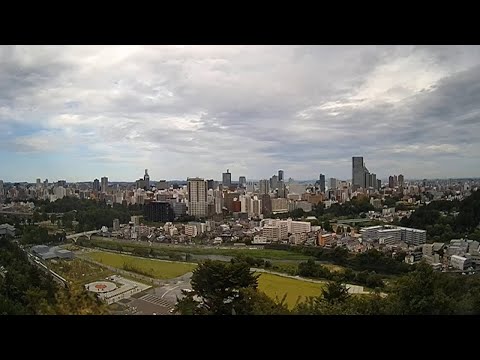
仙台城跡からの眺望
Sendai City's official camera looks out over the city from the castle ruins. Open the original YouTube page to check the latest view.
City of Sendai
Watch on YouTube
YouTube · Not live videoMiyagi
仙台市街地と仙台城跡をつなぐ大橋
Sendai city shares a view around Ohashi Bridge, which connects the city and castle ruins. The camera looks toward the castle hillside; the pin marks the approximate bridge area.
City of Sendai
Watch on YouTubeMiyagi
せんだいメディアテーク 定禅寺通り
Sendai Mediatheque publishes updated views of Jozenji Street toward the Bansui Street intersection. The official page also has a separate view of the building exterior.
Sendai Mediatheque
Open official cameraIwate
見返峠 八幡平アスピーテライン
Iwate Prefecture's road camera shows Mikaeri Pass, an approach to Hachimantai's summit walking trails. Check snow cover and visibility near the pass; the Dragon Eye pond is outside the frame.
Iwate Prefecture Road Environment Division
Open official cameraAomori
弘前公園 追手門前
Hirosaki city provides a camera at the Otemon entrance to Hirosaki Park. Select the Otemon camera on the official page for the gate area and seasonal scenery, rather than the separate castle-keep view.
City of Hirosaki
Open official camera