Japan Live Now is a directory of official webcams and updated camera images across Japan. Find a view by map, region or theme, read what it shows in English or Korean, and open the original source.
How can I find Japanese city webcams on the map?
Explore 473 cameras on the map or browse by region and theme. Thumbnails and descriptions help you choose a view even if you do not know the Japanese place name. Each detail page links to the original video or images; not every source is continuous live video.
Are these public webcams or private CCTV feeds?
These are publicly shared views from official operators, not access to private or security CCTV systems. Some sources offer live video; others update still images. Check the source’s timestamp and broadcast status for the latest view.
Advertising notice: This site is under Google AdSense review and does not currently show ads. Privacy policy
Guide updated:
Live cameras by city, sight and season
Choose a guide for the city, sight, season or outdoor trip you are planning. Every guide is built from real cameras published by official operators.
OFFICIAL CAMERA DIRECTORY
A window into Japan
View the video or updated images at the official source. Image update intervals and capture times depend on the operator.
Watch the streets and foot traffic around Ebisubashi in Dotonbori through Tonbori Station's camera. Take a look before heading out for a walk in Osaka.
Look down on Shibuya Scramble Crossing from SHIBUYA SKY in the East Tower of Shibuya Scramble Square. The map marks the filming site rather than the crossing; check the official channel for stream availability and the latest link.
See Mount Fuji in the camera image from the grounds of Kawaguchiko Lakeside Hotel. The snapshot updates roughly once a minute rather than providing continuous video, so check its timestamp when looking at cloud cover or snow.
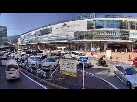
See Sapporo Station and the JR Tower area through STV's camera at Sapporo Medical Rehabilitation College. Open the broadcaster's official page for the station-area view.
See Hakata Station's forecourt and the surrounding city through KBC's camera. The map pin is an approximate reference near the station, not a confirmed camera installation.
Check Kiyomizu-zaka on the way to Kiyomizu-dera through MLIT's Kyoto National Highway Office camera. It does not show the main hall, its stage or Sannenzaka itself.
See the northern end of Kyoto's Philosopher's Path through the tourism association's camera. If you are planning a blossom or autumn walk, check the source image for the actual seasonal conditions.
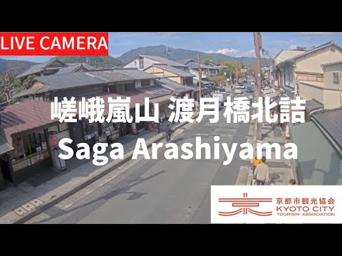
Check the area around Togetsukyo Bridge from the tourism association's camera at its north end in Arashiyama. The map pin marks the camera site, not the middle of the bridge.
See Odori Park and central Sapporo through STV's camera in the Meiji Yasuda Life Sapporo Odori Building, south of the park. Open the broadcaster's official page for the view.
See Shinjuku Station's east exit and plaza through Cross Shinjuku Vision's cat's-eye camera. Select 新宿猫の目線 on the official channel: this camera faces the station, not the cat billboard.
Watch the Japanese garden and pond at Suimeikan in Gero Onsen. The live camera shows the outdoor garden, with its carp and visiting ducks, rather than bathing areas.
See Kujo Pond and the historic Shusuitei teahouse in Kyoto Gyoen. The Ministry of the Environment's still images normally update about once per hour, so check the timestamp.
See Chidorigafuchi moat and its cherry-lined promenade from the boathouse roof. Bloom dates vary each year; check the Chiyoda Tourism Association's official page and channel for stream availability.
Look out over the surrounding city through Tokyo Tower's official observation camera. The map marks Tokyo Tower, not a landmark in the view; check the tower's official page for stream availability.
See the slopes and mountain town at Kamisenbon on Mount Yoshino, known for its spring cherry blossoms. The Ministry of the Environment's still images normally update about once per hour; this is not continuous video.
See the streets and sky around Otaru Canal through STV's camera at Hotel Nord Otaru. Open the broadcaster's official page for a look at the canal-side area before your walk.
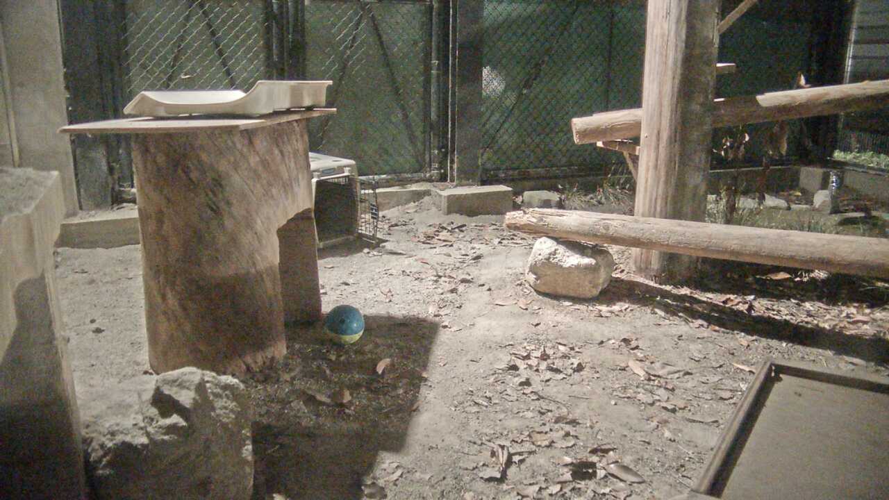
See the Tsushima leopard cat conservation enclosure at Fukuoka City Zoo through the Ministry of the Environment's camera images. Still images of the enclosure, which is closed to general visitors, normally update about once per hour rather than providing continuous video.
See the pond and courtyard garden at Mukaitaki, a traditional inn in Aizu Higashiyama Onsen. The camera shows the outdoor garden through the seasons, not bathing areas.
See the public footbath and Tsuzumi Bridge through Petit Hotel Yubara Resort's camera. It faces the hot-spring town's street, not indoor or open-air bathing areas.
See Jinnan and Koen-dori through Camera 03 at the Second Daigai Building, run by the Shibuya Koen-dori shopping district association. Watch on the official page; the operator's reuse restrictions mean we do not reproduce a thumbnail.
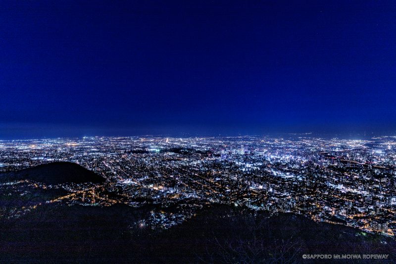
See the observatory area through the camera beside Mount Moiwa's summit elevation sign. The official page publishes a still image every ten minutes; the promotional photo on this page is not a live view.
Look across Lake Kawaguchi toward Mount Fuji from Oishi Park on the northern shore. Cable Television Kawaguchiko updates its still image about every five minutes; check the timestamp on the original.
Watch the official 4K live view of Mount Fuji from the upper observatory of the Mt. Fuji Panoramic Ropeway. Take a look toward the mountain before a ropeway ride or a walk on Mount Tenjo.
Look across Lake Kawaguchi toward Mount Fuji from Shuhokaku Kogetsu on the northern shore. Fuji's reflection may appear when conditions are right, but neither the mountain nor its reflection is always visible.
See Lake Kawaguchi and Mount Fuji through THE KUKUNA's official camera on the eastern lakeshore. This page uses a placeholder because the image provider restricts external image use.
See Lake Kawaguchi and Mount Fuji from MIZNO HOTEL on the hillside east of the lake. Open the original video to watch; the YouTube preview may differ from the scene being broadcast.
Look over Hakodate and the sea on either side from HBC's Mount Hakodate camera. It offers city views by day and lights at night, though the direction and image updates may change.
Look across Sapporo from STV's camera at the Okurayama Ski Jump Stadium summit observatory. This seasonal camera may pause or change direction, including for winter anti-icing measures.
Check Nene-no-michi near Kodai-ji through the Kyoto City Tourism Association's camera before walking around Gion and Kiyomizu. The view does not directly show Ninenzaka or Sannenzaka.
Take a look at Hanamikoji Street in Gion through the Kyoto City Tourism Association's camera. When visiting, follow local signs about private property and photography.
See a section of Arashiyama's Bamboo Forest Path through the Kyoto City Tourism Association's camera. The view covers part of the walk, not the entire grove.
Check the approach to Daikaku-ji through the tourism association's camera before exploring Saga and Arashiyama. It shows the approach, not the temple interior.
See the street outside Seiryo-ji, also known as Saga Shakado, through the Kyoto City Tourism Association's camera. This temple in Saga is a different place from Kiyomizu-dera.
See a stretch of Saga Toriimoto's historic streets through the Kyoto City Tourism Association's camera. Take a look before heading out for a walk in Okusaga.
Check the Urasando approach near Fushimi Inari through the tourism association's camera. It shows the nearby street, not the Senbon Torii tunnel or the mountain summit.
See the approach beside Kitano Tenmangu's south gate through the tourism association's camera. This is a street view at Kitano Tenmangu, not a view inside Kinkaku-ji.
Check Nishiki Market through the Kyoto City Tourism Association's camera. The listed broadcast hours are 11:00–18:00 Japan time, so the stream may be unavailable outside that window.
Check the approach to Ginkaku-ji, Kyoto's Silver Pavilion, through MLIT's camera. The view shows the street leading to the temple, not the pavilion or the garden inside.
Check visitor traffic at the five-way junction on Yufuin's Station Street through Yufu City's camera. Images update every 10 minutes from 09:00–17:00 JST, not as continuous video, and updates stop overnight.
See traffic at Shinmachi Intersection in central Yufuin through Yufu City's camera. Images update every 10 minutes from 09:00–17:00 JST and stop overnight, so check the image timestamp too.
Check visitor traffic on Otomaru Street through Yufu City's camera images. They update every 10 minutes from 09:00–17:00 JST and stop overnight; this is a street view, not a view of the hot-spring baths.
See Kurokawa Onsen village from the camera at the Kazenoya visitor center. Minamioguni Town's official page updates the image every five minutes; it does not show the bathing areas.
See the Kusasenri grassland and sky from RKK's camera on the Aso Volcano Museum rooftop. For hiking or visits near the volcano, check official alerts and access restrictions separately from the camera view.
See Mount Aso from Kurumagaeri in the Japan Meteorological Agency's periodically updated images. This is not continuous video; check official volcanic alerts and access restrictions before hiking.
See Tsurumidake and Garandake from Tsukahara Muta in the Japan Meteorological Agency's periodically updated images. This is not continuous video; check official volcanic alerts and access restrictions before a mountain visit.
See Bitchu Matsuyama Castle and the surrounding hills from Takahashi City's cloud viewpoint, with the camera available 04:00–23:00 JST. This is in Okayama, not Matsuyama Castle in Ehime.
Look over Onomichi, the Onomichi Channel and nearby islands from the Senkoji-yama Ropeway summit station. Open the ropeway operator's video for the view across the waterfront city.
Check crowds on Miyajima's Omotesando shopping street in images updated every 1–2 minutes. People are anonymized and placed on a fixed background; the background is not live scenery and cannot show current weather or daylight.
See Amanohashidate through the camera viewer on View Land's official website. Compare it with the Kasamatsu Park camera for another perspective on the landscape.
Check the summit area around Biwako Terrace through Biwako Valley's camera. The image updates about every ten seconds; check the operator's notices separately for ropeway service.
See the Ginkaku-ji grounds in still images updated every three minutes on the temple's official website. This view is inside the grounds, unlike the separate camera on the approach road.
See the city and sky around Tenmabashi and toward Osaka Castle through Television Osaka's camera. The scene changes with the camera direction; it does not show the castle interior.
Watch aircraft activity and the sky around Osaka International Airport, also known as Itami, through MBS's camera. Check the airline or airport separately for your flight's departure or arrival details.
See the Arima River around Koen Bridge near Arima Onsen Station through Kobe City's river camera. It shows the riverside, not the baths or the whole hot-spring town.
See mountain views through the official live channel linked by Rokkosan Visitor Center. Take a look at the sky and surroundings before heading up Mount Rokko.
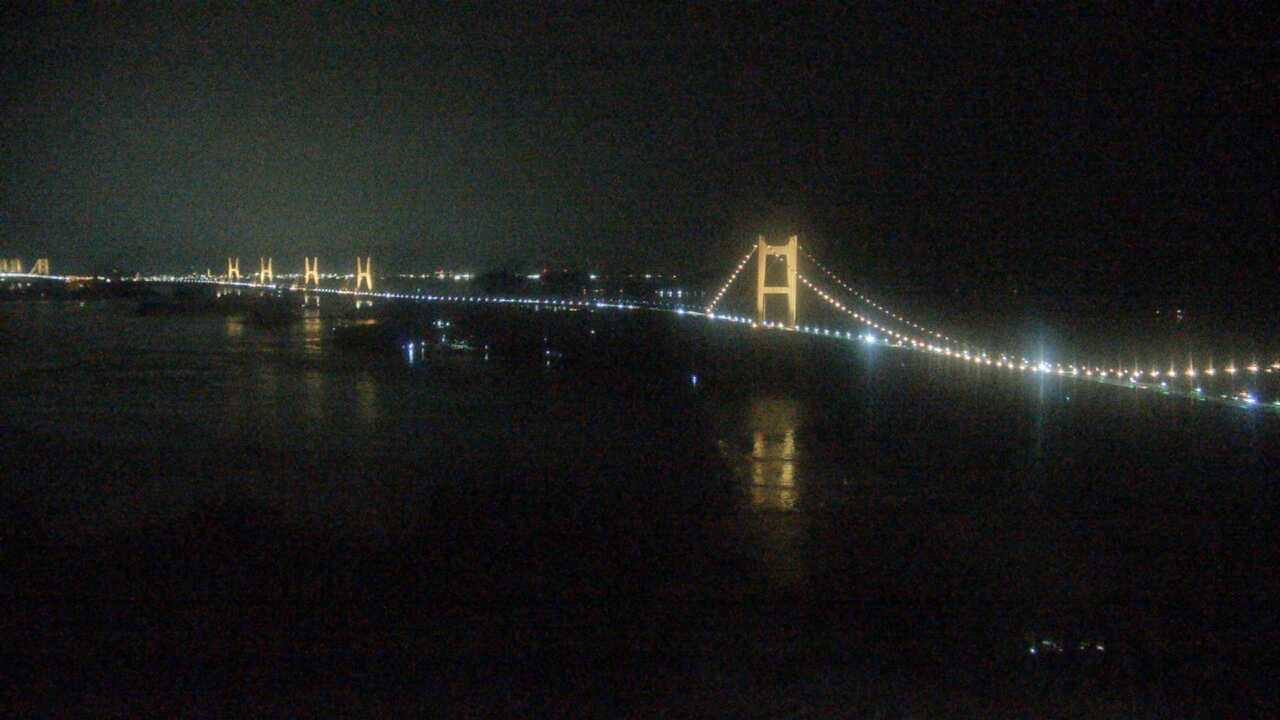
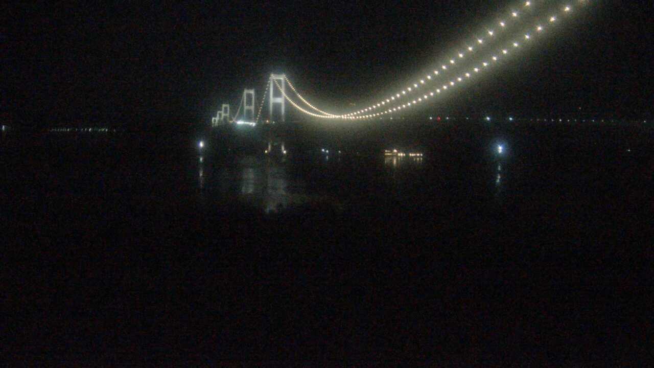
See the Akashi Kaikyo Bridge and surrounding strait through Maiko Villa Kobe's official camera. The view takes in the bridge and sky along the Maiko coast.
Watch Lake Tazawa through the official channel linked by Semboku City's tourism information. The map uses an approximate lakeshore reference near the Tatsuko statue, not a confirmed camera mount.
See Kakunodate's samurai district through the camera linked by Semboku City. Check the source view for actual conditions if you are planning a visit for cherry blossoms or autumn foliage.
See the rock formations and riverside scenery at To-no-hetsuri through Shimogo Town's camera. Check the source video for a look at the gorge before your visit.
See the stone-step street in Ikaho Onsen through Shibukawa City's official camera. Check the street and weather before walking around the hot-spring town.
See Kenrokuen Garden through the camera listed by Kanazawa City. If you are visiting for flowers or autumn foliage, check the source view alongside seasonal information.
See Matsumoto Castle and its surroundings through Matsumoto City's official camera. Check the source video for weather and seasonal scenery before visiting.
See Shirakawa-go through Shirakawa Village's official camera. Images may be intentionally blurred to protect residents' privacy; we do not remove the blur or alter the source images.
See Kintaikyo's wooden arches and riverside scenery through Iwakuni City's official camera. Take a look at the surroundings before visiting the bridge.
See the area around Juhyo Kogen, an intermediate station on the Zao Ropeway, through the official camera. Zao's snow-covered trees, known as snow monsters, form in particular winter conditions; check the source image before planning a visit.
See Shinmon Street on the approach to Izumo Taisha through the Shimane Tourism Federation's camera. The view alternates north and south along the street, not inside the shrine.
Look toward Morioka Castle Park through the Morioka Tourism and Convention Association's camera. The map pin is an approximate reference near the central fire station named in the official description.
Look toward the Kushiro River and Nusamai Bridge through STV's camera. The official page gives different installation details in Japanese and English, so the map uses an approximate reference near the bridge.
The Ministry of the Environment camera at Yokoyama Viewpoint's sky cafe terrace overlooks Ago Bay. It provides periodically updated photographs rather than continuous video; check the capture time before using the view to plan a visit. The marker uses the ministry's facility reference, not a verified mounting point.
The Ministry of the Environment provides periodically updated photographs from the Waterfowl and Wetland Center on northern Lake Biwa. Birds may not always be visible. Images are not acquired on Tuesdays (the next day when Tuesday is a holiday) or December 29–January 3, so check the capture time. The map uses an approximate facility reference.
A Ministry of the Environment camera showing the sea from Kushimoto Marine Park's underwater observation tower. Photographs update about hourly during daylight, not as continuous video. Water clarity and the viewing window may obscure the scene, and fish are not always visible. The marker uses an approximate facility reference from the official camera map, not a surveyed mount.
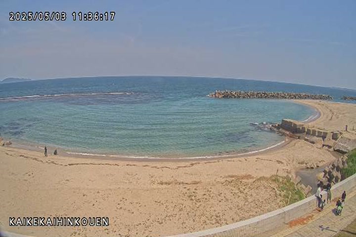
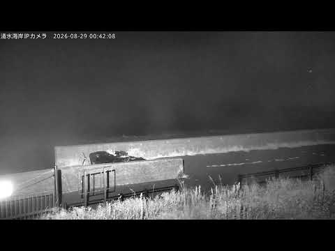
Coastal observation images provided by the Ministry of Land, Infrastructure, Transport and Tourism's Hino River Office at Kaike Seaside Park. Check the seafront weather while planning a walk during a Kaike Onsen visit. This is not a camera inside a bath or overlooking the hot-spring streets. Darkness, rain and water on the lens may obscure the view; check the timestamp on the original image. Do not use it to determine swimming safety, and stay away from the coast during high waves.
Nara Prefecture’s updating road snapshots help with a visit to Nara Park and Todaiji. This is an approach-road view, not a deer camera or the temple interior.
Chichibu City publishes photos from Tabidachi no Oka in Muse Park about every five minutes. Cloud formations vary; check the capture time on the official page.
The Nagatoro Tourism Association publishes updating photos of Nagatoro Station Square. Check the station approach and nearby cherry trees and the capture time on the official page.
The Nagatoro Tourism Association publishes updating photos of Nagatoro Iwadatami Rocks. Check the Iwadatami rock formations and riverside and the capture time on the official page.
The Nagatoro Tourism Association publishes updating photos of Hodosan Shrine Approach. Check the shrine approach, turning area and surrounding trees and the capture time on the official page.
The Nagatoro Tourism Association publishes updating photos of Kami-Nagatoro Station. Check the station entrance and southern cherry-tree avenue and the capture time on the official page.
Open the Natural Parks Foundation’s official live channel for Kirifuri Kisugedaira. Preview the highland setting and check current broadcast availability there.
An official Natural Parks Foundation view from Kusasenri Viewpoint toward the grassland and Aso Nakadake. Check local notices separately for crater access.
The ropeway shares views over Otaru from the summit observation area. Select the current broadcast on its official channel; the spring view may include the Tengu cherry tree.
Official updated photographs from Usuzan Ropeway summit station. Check visibility on the mountain and consult the operator separately for ropeway service.
Roughly five-minute photographs from Hinode Park viewpoint. Check the lavender hillside and town view, using the image timestamp when assessing flowers.
Kamifurano provides east- and west-facing photographs around Tokachidake Onsen at roughly five-minute intervals. Select a direction on the official page. This is not a bath interior camera.
Sendai city shares a view around Ohashi Bridge, which connects the city and castle ruins. The camera looks toward the castle hillside; the pin marks the approximate bridge area.
Updated views published by Sendai Mediatheque, including Jozenji Street toward the Bansui Street intersection. The official page also has a separate view of the building exterior.
Iwate Prefecture shows Mikaeri Pass, an access point for Hachimantai summit walks. This public road camera helps assess snow and visibility; it does not show the Dragon Eye pond itself.
Hirosaki city provides a camera at the Otemon entrance to Hirosaki Park. Select the Otemon camera on the official page for the gate area and seasonal scenery, rather than the separate castle-keep view.
Akita City streams the moat and Nakadobashi area of Senshu Park from the rooftop of Nigiwai Koryukan AU. View the seasonal waterside and nearby Milhas nightscape. The marker indicates the AU building vicinity, not the park centre.
Kanpuzan Observatory shares its view towards Funakawa in Oga on its official YouTube feed. Check visibility over the hillside and towards the coast. This fixed-direction camera does not show every side of the rotating observatory.
Selion provides a sea-facing camera at Akita Port. Choose “セリオンから海側” on the official website for the harbour-side view. The original viewer uses an older HTTP page, so some browsers may show a security notice.
Ginzanso provides an outdoor camera from its fourth floor. Select “銀山荘4階屋外” near the bottom of the official website. This is a different viewpoint from the Kosekiya camera in the historic onsen street, and opens in an older HTTP viewer.
Hijiori’s official tourism site recommends Kotobukiya’s live camera. Check the outdoor scenery, weather and snow around the Dozan River in the onsen village. The view is near the restaurant, not inside a bathing area.
Inawashiro Ski Resort links to this official live-camera channel. Select an available view of the slopes or lake-facing scenery there. The marker is an approximate reference within the resort area, not the confirmed mount of a specific camera.
Tsukuba City’s official camera looks toward the Kanto Plain from the ropeway station just below Nyotai’s summit. Check the weather and distant views; clouds or fog can obscure the panorama.
Tsukuba City’s official camera looks uphill from the middle of the plum grove. See the grove during plum-blossom season and check its weather year-round. These are plum trees, not cherry blossoms; the marker is an approximate grove reference.
Daigo Town provides this camera of Fukuroda Falls and its seasonal surroundings. Open the separate viewer from the official information page. The original viewer uses HTTP; the marker is an approximate reference in the waterfall viewing area.
Daigo Town links to this camera at Tsukimachi Falls near Momijien. Check the waterfall and its seasonal scenery using the separate HTTP viewer on the official page. The marker approximates the falls and Momijien vicinity, not a verified mounting point.
Daigo Town provides this view toward Okukuji Mount Nantai from near Oenji Sanso at the mountain’s foot, not from the summit. The marker approximates the lodge and trailhead vicinity. Open the original HTTP viewer from the official page.
Oarai Tourism Association provides this Sun Beach live camera. Check the beach and sea conditions. The original uses HTTP and may ask for the public access details shown on the official page. The marker is an approximate reference near the beach.
Nikko’s tourism association links to Futarasan Shrine’s camera at Shinkyo. Check regularly updated pictures of the red bridge and Daiya River surroundings. Select 神橋 on the official list. The marker approximates the bridge vicinity; the original information includes an HTTP page.
Nikko Bussan Shokai provides this official camera from its Kanaya Hotel Bakery branch opposite Tobu Nikko Station. See the station forecourt and bus interchange area. The approximate marker is by the station branch, not the company’s main shop at Shinkyo.
Nikko’s tourism association links to the official YouTube camera at Futarasan Shrine Chugushi on Lake Chuzenji’s north shore. Check scenery and weather around this shrine. It is not the main Futarasan shrine in the World Heritage area or inside Toshogu.
Futarasan Shrine provides this Mount Nantai summit camera, listed by Nikko’s tourism association. Select 男体山山頂 on the official list for updated pictures. Weather figures on the same original page may be old; distinguish them from the image timestamp. The approximate marker uses the published observation-site coordinates.
Nikko’s tourism association recommends Hotel Kojoen’s official live channel. Select an available broadcast for lake views from near this Chuzenji Onsen hotel. The marker approximates the hotel’s location; this is not a camera inside a bathing area.
Minakami’s tourism association recommends Seiryu no Yado Tamura’s official camera channel. Check outdoor scenery and weather around the inn in Yunokoya Onsen. The marker approximates the inn, not a location inside Teriha Gorge or a bathing area.
Hodaigi Ski Resort’s official camera looks toward the main slopes and the boarding areas for lifts 6 and 8. Check seasonal slope scenery and snow. The marker is an approximate reference within the resort area, not the confirmed camera mount.
Tanigawadake Joch and Mt.T’s current official conditions page links to this camera channel. Select an available broadcast for Tenjindaira slope and lift-area scenery. The marker approximates Tenjindaira Station’s vicinity, not Mount Tanigawa’s summit.
Official periodic photographs from Tokyo Power Technology, linked by the Oze Preservation Foundation. Select 鳩待峠 on the original page for the view toward Mount Shibutsu, normally updated every ten minutes. The marker approximates Hatomachi Pass in Gunma, not the mountain summit.
Tokyo Power Technology’s official Toden Hut camera is linked by the Oze Preservation Foundation. Select 東電小屋 for periodic photographs of Ozegahara toward Mount Shibutsu, normally updated every ten minutes. The approximate hut location is in Uonuma, Niigata, separate from the Hatomachi Pass camera in Gunma.
The temple’s official website provides this view of Naritasan Shinshoji’s main hall forecourt. Open the official YouTube channel and choose an available broadcast. The marker uses the tourism association’s approximate main hall location, separate from the Somon gate camera.
Narita City Tourism Association states that its Somon gate camera continues beyond the New Year period. Choose an available broadcast on the association’s official YouTube channel. The marker approximates the gate using the association’s map coordinates, distinct from the main hall forecourt.
The area development council’s official camera overlooks Tokyo Station’s red-brick facade and Marunouchi plaza. The marker approximates the Marunouchi Building from which the view is provided; it does not represent a camera inside the station or on a platform.
Tokyo Metropolitan Park Association provides periodically refreshed photographs of Rikugien’s weeping cherry and Shinsentei surroundings. The original page offers both viewpoints, normally from 9:00–17:00 JST and until 21:00 during illumination periods. The marker is an approximate garden reference, not the exact mounting point of either camera.
Kanda Myojin’s official visitor information page provides two views of its courtyard and approach, refreshed about every ten minutes. The marker approximates Zuishinmon Gate. These periodic photographs are separate from the shrine’s general YouTube videos and past festival broadcasts.
Tokyo’s Bureau of Environment publishes official observation photographs toward Mount Fuji from the government building’s 31st floor. Check the capture time and standard or zoomed photograph on the original page; Mount Fuji may be obscured by weather. The approximate marker is at Main Building 2, not the public 45th-floor observation deck.
Juyoh Hotel’s official website links to its Skytree-view channel. The camera looks toward the tower from Kiyokawa in Taito, rather than from inside Skytree or its base. The marker approximates the hotel. Select an available broadcast on the official channel.
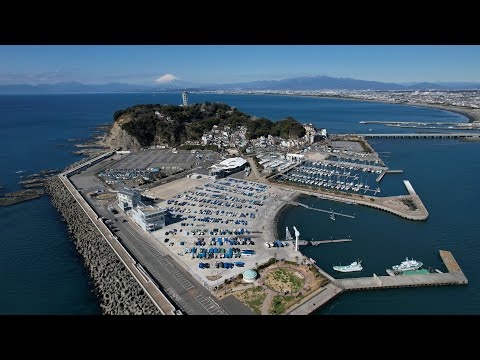
Riviera, the operator of Enoshima Yacht Harbor, provides this official harbor and sea view. Check the local atmosphere before an Enoshima walk. The marker approximates the harbor facilities rather than placing the camera on the water it overlooks.
Television Kanagawa’s official broadcast shows Yokohama’s cityscape and sky from its rooftop. The approximate location is the Yokohama Media and Business Center in Otamachi. This is not a dedicated camera inside Minato Mirai attractions or Chinatown.
Minamiashigara City and Hakone Tourist Association link to this official camera at Kintaro Chaya on Mount Kintoki. Open the original page for summit-area mountain scenery. The marker approximates the teahouse. Commercial footage reuse requires prior consultation, so this site provides an original-page link only.
Kujukuri Town provides this coastal camera from the Sunrise Kujukuri public guesthouse. Select 別ウインドウで開く on the official page to open the original viewer. It is a legacy HTTP viewer and may require a separate window depending on the browser. The marker approximates the guesthouse.
Kamakura City links to these periodic, privacy-blurred images of Koshigoe Rakko Park near Kamakurakokomae. The public feed continues after the city and SKIDAY tourism pilot, helping visitors check crowding around the designated photography area. Check the capture time on the original site. This is not continuous video of the entire railway crossing or station platform; the marker approximates the park vicinity.
Periodic images of the Bandai Bridge vicinity, supplied by the MLIT river office through Niigata's official camera network. Check the setting around Niigata's landmark bridge and the Shinano River. Images update about every 10 minutes; the view may change for emergency operations. The marker is a bridge-vicinity reference, not a verified camera mount.
Sado City's periodic camera images show the Onogame coastal area. Check the landmark setting and local weather on the official page, which provides approximately one-minute updates. The view can change during severe weather because the camera also serves disaster monitoring. The marker approximates the lodge and parking area, not a camera on the rock summit.
Sado City's periodic images show Ogi Port, a gateway to southern Sado sightseeing. View the harbor and ferry surroundings through approximately one-minute updates. Camera direction may change during severe weather or emergency operations. This is not a dedicated view of tub-boat rides or inside Shukunegi village. The marker approximates the ferry terminal.
The official Myoko Kogen Sky Cable website links to periodic images from Sky Terrace near its upper station. Open スカイテラス ライブカメラ to check the highland scenery and capture time. The Shin-Akakura town camera and promotional video on the same page are separate. The marker uses approximate upper-station coordinates from the official public camera data.
Yuzawa Kogen's official page provides two periodic views: in front of the Edelweiss panorama restaurant toward Minamiuonuma, and near the upper ropeway Panorama Station toward Mount Omine. Select the views on the original page. One approximate highland-facility reference represents this combined listing, not the exact mounting points of both cameras. Check the original capture times and operating notices.
The tourism bureau's live camera shows the hot-spring fountain plaza and nearby railway crossing at Unazuki Onsen Station. Open the official YouTube feed for the town atmosphere and winter conditions. The marker is approximate around the station-front fountain, not a verified mount. This is not a bathing-area or whole-gorge camera.
The roadside station's official website links to its coastal live-camera channel. Check the Amaharashi coast and Toyama Bay scenery before visiting. The button opens the official channel's live-stream list; consult it for current broadcasting status. The marker represents the approximate roadside-station location.
The official Kurobe Dam page provides periodic dam and mountain views approximately every 60 seconds. Its stated camera season is April 15–November 30, with sightseeing discharge June 26–October 15. This approximate observatory/rest-area marker is separate from the Kurobedaira camera. Check capture times and seasonal notices on the original page.
Nanto City's tourism camera provides periodic views of the World Heritage Ainokura gassho village and nearby terraced fields. The visible scene depends on the original camera's selected direction. The marker is approximate around the entrance parking area. Because the official site prohibits unauthorized image reuse, this listing links to the city viewer without copying its preview.
Nanto City's tourism camera shows the World Heritage Suganuma gassho village in periodic images. The marker uses the city's mapped Niter Museum area within the village as an approximate reference. Suganuma is distinct from Ainokura and from Shirakawa-go in Gifu. Image-reuse restrictions mean that viewing takes place on the official city page.
Nanto City's periodic camera looks over the Shogawa gorge reservoir and mountains from Yuraku Onsen. Depending on the selected direction, the original shows upstream, downstream or mountain scenery, not the bathing area. The marker is approximate around the hot-spring facility. Open the official page for current views; its image-reuse restriction is respected.
Nanto City's tourism camera provides periodic views around Sakuragaike Lake and Park; the scene varies with its selected direction. The city announces a roughly three-year park renovation closure from June 2024, while the lakeside walking path remains accessible according to its notice. Check current notices before visiting. The marker is approximate around the park; view images on the official page.
Tulip Television's official live feed shows Toyama Station's south plaza, station building and trams entering and leaving the station. The button opens the original YouTube feed. The marker is approximate around the plaza's Shintomicho side, not a verified mounting point. This is not the station's north side or a view inside Kansui Park.
Toyama Television's official Himi weather camera provides coastal scenery toward Toyama Bay. The approximate marker uses the Himi Station/Jizomachi area identified for the camera, not a verified mount. This is a distant coastal and harbor view, not a dedicated camera inside Himi Banya-gai market. The button opens the official YouTube feed.
Imizu Cable Network's official live camera shows the Kaiwomaru Park waterfront. The city's tourism-camera notice locates it on a building rooftop near the park and Shinminato Bridge. The approximate park reference is not the exact rooftop mount. The visible sailing ship, bridge and Toyama Bay scenery varies with camera direction. Open the original YouTube feed to view it.
Tonami City's Panorama Terrace camera looks across Tulip Park. The city also lists BUNZO-NE and waterwheel views in this park. The marker represents the park, not the camera mount; tulip displays are seasonal.
Tonami City's camera covers the Yumenotaira Cosmos Lodge and ski area. Autumn flowers and winter slopes are seasonal; the visible area depends on the direction selected on the original site. The marker is an approximate lodge reference.
Tonami City's Mount Hachibuse camera offers views over the plain and scattered farm settlements. Direction selections can also face the bay or Tateyama range. The approximate summit reference is separate from the Sankyoson lookout parking area.
Tonami City's camera covers the specialty-products hall area in Shogawa Water Memorial Park, not indoor exhibits or a dedicated footbath view. The city has announced redevelopment including some facility removals; check current visitor access notices. The marker approximates the hall vicinity.
Tonami City's camera offers selectable views around the Shogawa Gorge cruise landing, including boarding and ticketing areas. Autumn foliage and winter scenery vary seasonally. This is not an onboard cruise or an interior view of Omaki Onsen; the marker approximates Komaki landing.
Ishikawa Prefecture's official camera covers Gyokuseninmaru Garden at Kanazawa Castle, a separate garden from Kenrokuen. Seasonal planting, pond and stone-wall scenery vary with conditions and framing. The marker approximates the garden rather than a verified camera mount.
Ishikawa Prefecture's Sannomaru camera shows an outdoor square at Kanazawa Castle Park. It is distinct from the garden feed and the separate Ninomaru reconstruction-site camera. The marker represents the square, not an identified mounting point.
HAB's official sunset feed looks toward the Chirihama coast and horizon. The approximate marker uses Noto Chirihama Rest House; this view does not establish whether the entire beach driveway is open to vehicles.
Nanao City's current camera directory links this Shiroyama Observatory feed. The lookout offers distant views toward Nanao Bay. Its approximate tourism-map point is not the castle's Honmaru ruins or a camera inside Wakura Onsen.
Kanazawa's tourism association publishes this Omicho Market camera. Use it for a glimpse of the market area, not as confirmation that every stall is open or as a complete crowd measure. The marker is an approximate market reference from the official tourism map.
The city tourism association's Nagamachi feed offers a street view around the samurai district. The approximate marker uses the Nagamachi rest house identified near the camera. This is not an interior tour of individual samurai residences.
Kanazawa's tourism association publishes this Higashi Chaya street feed, distinct from the existing Asano River camera. It shows the outdoor district rather than teahouse interiors. The marker uses an approximate point from the official tourism guide.
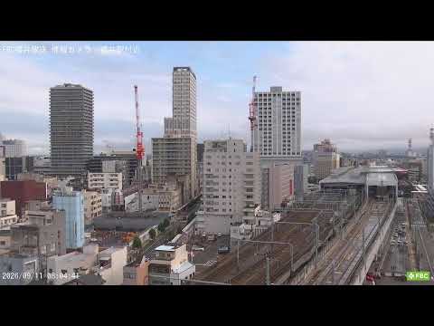
FBC's official camera looks toward Fukui Station and its railway surroundings from the south. It offers a railway and city-weather view, not a close-up of the dinosaur plaza or platform interiors. The marker represents the approximate filming area.
FBC's official camera covers the Daimyomachi crossing and downtown west of Fukui Station, including the tram streetscape. The marker is approximate around the reported Senkyo Building filming site. This is not an interior castle view or the station dinosaur plaza.
Ono City's official camera looks outward from Echizen Ono Castle toward the town and possible cloud seas. Clouds depend on weather and time. This is not the distant Inuyama viewpoint showing the whole castle floating above clouds. The marker is approximate around the castle; visitor opening dates and camera availability may differ.
The Rainbow Line operator provides periodically updated summit-park photographs under 山頂公園カメラ on its official homepage. Use them for a local weather and viewpoint check before visiting. This is not continuous video and does not guarantee a view of all five lakes. Check the original capture time; the marker is approximate around the summit park.
Katsuyama City provides periodic photographs of the Terao-crossing approach to Nagaoyama Park, home to Fukui Dinosaur Museum. Select 長尾山総合公園(寺尾交差点側)道路状況 in the official viewer. This shows the visitor approach, not museum interiors or dinosaur exhibits. Capture times vary by camera; check the timestamp on the original.
Katsuyama City's periodic photograph shows the parking area in front of Echizen Daibutsu. Select 越前大仏前駐車場 in the official viewer to check the visitor approach. This is not a view of the Buddha statue or temple interiors. It is not continuous video; check the original photograph's capture time.
Katsuyama City publishes periodic photographs of the parking area by Mahoroba, the visitor information facility for Heisenji Hakusan Shrine. Select まほろば前駐車場 in the official viewer. This is a visitor approach, not the moss forest or shrine interior. Check the capture time and update status on the original.
The tourism association publishes ten-minute photographs from the Shosenkyo ropeway summit toward Kofu Basin and Mount Fuji. Fuji may be hidden by weather. This is not a close view of the gorge floor or Kakuenbo rock.
The tourism association publishes ten-minute photographs looking north from the ropeway summit toward Nosen Lake and Arakawa Dam. This is a different direction from the summit's Fuji camera. The marker represents the summit facility, not a camera in the middle of the lake.
Kuonji's official camera, installed at Shakaden Shinnouhaido, shows the precinct around Soshido and the side of the main hall, including seasonal weeping cherry blossoms. The temple says it displays a few images per minute rather than smooth continuous motion. It is not an indoor ceremony feed, and wireless issues may interrupt updates.
Sun Meadows Kiyosato publishes a viewpoint photograph under 清里テラスより野辺山高原 on its camera page. It provides a summit-area weather and highland outlook. The source capture timestamp could not be verified, so an immediately current scene is not guaranteed. Check terrace opening and lift operation separately.
UTY's official camera at Fuji Kanko Kaihatsu headquarters overlooks Kawaguchiko Station surroundings, useful for the railway and arrival-area atmosphere. The broadcaster may switch views for reporting or emergencies. It is not an indoor station or dedicated lake feed.
UTY's official rooftop camera at Yamanashi Science Museum overlooks the Kofu Basin cityscape and surrounding weather. It does not show museum exhibits or Takeda Shrine interiors. Camera direction or content may change with broadcasting operations.
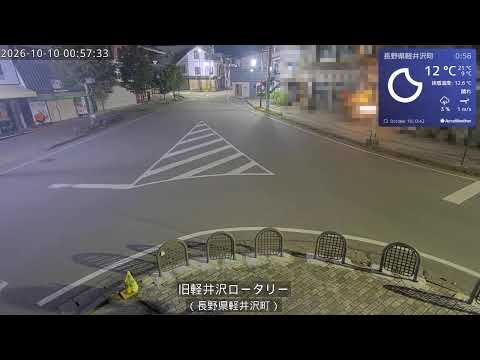
Karuizawa Town's official camera shows the rotary at the entrance to the old Ginza shopping street. It helps visitors check local conditions before exploring the historic district. This is not a view inside shops or coverage of the entire street; the marker is approximate around the rotary.
Karuizawa Town's official camera shows Kumoba Pond and nearby trees, useful for checking weather and seasonal autumn foliage. Colour timing varies each year, and the view does not represent crowding along the entire walking trail. The marker is approximate around the pond shore.
Karuizawa Town's official camera covers the area near the station's north plaza, a gateway toward the old town. Use it for the arrival-area atmosphere and weather. It does not show the south-side shopping plaza or platform interiors. The marker is approximate around the north plaza.
INC Nagano Cable Television publishes this official camera at Zenkoji's Sanmon gate. Views may alternate between the main-hall direction and Nakamise, providing a sense of the precinct before a visit. It is not an indoor main-hall feed. The marker is approximate around the gate.
Jigokudani Yaen-koen publishes current photographs around its monkey-only outdoor hot spring. Check the live-camera section and update time on the official homepage. Wild monkeys may not visit depending on season and conditions. This is not a human bathing area, and monkey appearances are not guaranteed.
Togakushi Tourism Association publishes periodic images, normally every ten minutes. The tourism information center overlooks the Chusha courtyard. Snow-melting equipment below the view can make conditions differ from nearby paths. Updates may pause; check the timestamp on the official source.
Togakushi Tourism Association publishes periodic images, normally every ten minutes. Donguri House overlooks Kagami Pond toward the mountains. Check the lakeside scenery and autumn colors before a walk. Updates may pause; check the timestamp on the official source.
Togakushi Tourism Association publishes periodic images, normally every ten minutes. The ranch management office looks toward the campground. The marker represents the ranch vicinity. The view does not indicate campsite availability or guarantee animals will appear. Updates may pause; check the timestamp on the official source.
Togakushi Tourism Association publishes periodic images, normally every ten minutes. This view shows the Okusha approach entrance. The marker is near the entrance parking area, not the inner sanctuary or the entire cedar-lined trail. Updates may pause; check the timestamp on the official source.
Togakushi Tourism Association publishes periodic images, normally every ten minutes. A camera beside the parking-area steps shows the Hokosha entrance. The marker represents the shrine vicinity, not an indoor sanctuary view. Updates may pause; check the timestamp on the official source.
UCV Ueda Cable Vision broadcasts the courtyard toward Kitamuki Kannon's main hall from the bell tower. It is an outdoor temple view in Bessho Onsen, not a bath or main-hall interior. The marker is approximate around the temple.
Operated by UCV Ueda Cable Vision. This official camera shows the weeping-cherry area in front of Ueda Castle's gate. It offers spring blossom views and the gate surroundings in other seasons; check the source for current flowering. The marker is approximate around the landmark, not a verified camera mount.
Operated by UCV Ueda Cable Vision. This separate official camera looks down over the area in front of Ueda Castle's gate. Check the park surroundings before visiting; it is not an indoor exhibition feed. The marker is approximate around the landmark, not a verified camera mount.
Operated by UCV Ueda Cable Vision. This official camera shows the outdoor precinct of Sanada Shrine in Ueda Castle's former inner compound. Check the scene before a shrine visit; it is not an indoor view. The marker is approximate around the landmark, not a verified camera mount.
Operated by UCV Ueda Cable Vision. This official camera shows the rotary and plaza outside Ueda Station. Check the station surroundings before continuing to Ueda Castle or Bessho Onsen; it is not a platform view. The marker is approximate around the landmark, not a verified camera mount.
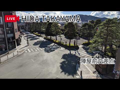
The tourism association camera covers the streets in front of Takayama Jinya. It does not show the building interior or guarantee that the morning market is operating. The marker is approximate around the landmark, not a verified camera mount.
The tourism association camera shows the red Nakabashi Bridge over the Miyagawa. Check its surroundings before a walk through the old town. Cherry blossoms and snow depend on season and weather. The marker is approximate around the landmark, not a verified camera mount.
The tourism association camera offers a panorama toward Takayama and the mountains from Alps Sky Park. It is not a close-up of pedestrians in the old town; mountain visibility depends on weather. The marker is approximate around the landmark, not a verified camera mount.
The ropeway operator provides this observatory camera toward Gifu. It is not an interior view of Gifu Castle and does not confirm whether the castle is open. The marker is approximate around the landmark, not a verified camera mount.
The official ropeway camera shows the Northern Alps from the summit observatory at Nishihotakaguchi Station. Clouds and seasons affect mountain, snow and autumn views. Consult the operator separately for trail safety and ropeway operation. The marker is approximate around the landmark, not a verified camera mount.
Shizuoka Prefecture's civil engineering office provides this coastal camera in the Miho area, north of groyne No. 1. It is not a close-up of the Hagoromo pine and does not guarantee a Mount Fuji view or safe swimming conditions. The map marks the approximate facility vicinity, not a verified camera mount.
Shimoda Yamatokan links to periodically updated photographs of Tatadohama Beach. These are still images rather than continuous video, useful for checking the beach and sea atmosphere. Consult local guidance separately for surf and swimming safety. The map marks the approximate facility vicinity, not a verified camera mount.
The park provides updated photographs from its summit area toward Mount Fuji and Suruga Bay. These are not continuous video; cloud and fog may obscure the mountains. The marker is an approximate facility location, not a verified camera mount.
This official camera faces Mount Fuji from PANORAMA TERRACE 1059 at Jukkoku Pass. Visibility varies with weather. Check the operator's notices separately for cable car service. The marker is an approximate facility location, not a verified camera mount.
This official camera faces toward Suruga Bay from the summit of Jukkoku Pass. It is a different view from the summit's Fuji camera, not a close-up camera on the coast. The marker is an approximate facility location, not a verified camera mount.
This camera was jointly installed by CASHIME on the third floor of MIRAI TOWER and Trinity, overlooking Hisaya Odori Park in Sakae. It does not show the inside of the observation deck or Nagoya Castle. The marker represents the tower facility, not a verified mounting point.
Periodically refreshed photographs from the roof of Gozaisho Ropeway's Summit Park Station. The operator describes one-minute updates during business hours and possible freezing in winter. Check official notices separately for ropeway operation. The marker is an approximate station reference.
TV Osaka News provides this official camera showing the area around JR Osaka Station in Umeda. It is not a view inside the Umeda Sky Building observation deck or of Namba. The marker is an approximate reference near Osaka Station; the installation building and exact camera mount have not been verified.
The Awaji Island Monkey Center links this official facility live camera from its website. Wild monkeys may be absent depending on the season and time. The marker shows the approximate facility location; the exact camera mount has not been verified.
Sainanin temple on Koyasan provides this official garden live camera. It shows the rock garden and seasonal cherry blossoms, autumn colors or snow when present. This is separate from the morning prayer broadcast. The marker is an approximate facility reference from the official access map, not a verified camera mount.
Shirahama Town provides this official view of Shirarahama Beach. It offers a look at the sandy beach and its surroundings and is a separate source from the Musashi ryokan camera. The marker is an approximate beach reference, not a verified camera mount. Service may pause without notice for maintenance.
Daisen Tourism Organization provides this camera from its tourist information center. Check the mountain area's weather and seasonal scenery before a visit. The marker shows the approximate information-center location, not a verified camera mount. The YouTube preview does not guarantee the current scene.
Adachi Museum of Art provides this official live view of its Japanese garden. Explore the garden's atmosphere before visiting Yasugi. The marker is an approximate museum location, not a verified camera mount. The YouTube preview does not guarantee the current scene.
San-in Cable Vision provides this view of Shinjiko Ohashi and Matsue's waterfront. The bridge and lakeside cityscape offer context before a walk around Matsue. The marker is an approximate reference at the bridge's northern end, not a verified camera mount. The preview does not guarantee the current scene.
This official tourism-facility camera overlooks Tadanoumi Port, the gateway to Okunoshima, or Rabbit Island. It shows the port and ferry boarding area, not rabbits on the island. The marker is an approximate port-facility reference, not a verified camera mount. Check official ferry notices separately for operating status.
Shodoshima International Hotel provides this camera overlooking Angel Road through its official page. Periodically updated images show the sea and sandbar. Check official tide guidance separately before crossing. The marker is an approximate hotel location, not a verified camera mount.
The Ishizuchi Mountain Range Partnership Council provides this periodically updated view toward Mount Ishizuchi from Jojusha Shrine. Fog or cloud may obscure the mountain. The camera does not establish trail safety or access conditions. The marker is an approximate shrine location, not a verified camera mount.
Ino Town Tourism Association provides this official camera at Nikobuchi, known for its Niyodo Blue water. Weather and light affect the view and water color. The marker is an approximate landmark reference, not a verified camera mount. Check official visitor guidance before visiting.
Kochi's official tourism site lists this Ioki Cave camera as provided by Aki City. Follow the official feed for a view of the cave attraction. The marker is an approximate landmark location, not a verified mount or confirmation that the full cave route is accessible. The preview does not guarantee the current scene.
KBC Kyushu Asahi Broadcasting provides this camera overlooking Kokura Castle in central Kitakyushu. Open the official YouTube feed to see the castle surroundings. The marker is an approximate Riverwalk Kitakyushu facility reference, where KBC's branch is based, not a verified camera mount. The preview does not guarantee the current scene.
Nagasaki Cable Media provides this camera looking over Nagasaki Harbor and the city from Mount Nabekanmuri. Use the official feed to check the harbor outlook and city lights before visiting. The marker is an approximate park reference, not a verified camera mount. The preview does not guarantee the current scene.
Nagasaki Cable Media provides this city outlook from the roof of Nagasaki City Hall. Follow the official YouTube feed for views toward the harbor and surrounding city. The marker is an approximate building reference, not a verified rooftop mount. The operator describes this as a limited-period feed that may end without notice; its preview does not guarantee the current scene.
Aso Design Center provides this Daikanbo camera showing the viewpoint parking area with grassland and mountain scenery beyond. Check the official feed for the surroundings before visiting. The marker uses an approximate area reference from the official camera map, not a verified camera mount. The preview does not guarantee the current scene.
Aso Design Center's official camera shows Shin-Aso Bridge, the surrounding hills and the viewpoint forecourt. The marker is an approximate facility-area reference, not a verified camera mount. The preview does not guarantee the current scene.
Aso Design Center provides this camera at Asobonosato Kugino, showing the visitor facility's parking area and buildings with surrounding mountain scenery. The marker is an approximate facility-area reference, not a verified camera mount. The preview does not guarantee the current scene.
A lakeside camera linked from RECAMP Beppu Shidakako's official facility listing, offering a view of the lake and its natural surroundings in the hills above Beppu. The marker is an approximate campsite reference, not a verified camera mount. The YouTube preview is a representative image and does not guarantee the current scene.
UMK TV Miyazaki's official camera looks toward the Kirishima Mountains and Shinmoedake from Takaharu Town Hall. This is a distant view from the town, not a summit camera. The marker is an approximate town-hall reference rather than a verified mount. The representative thumbnail does not indicate current volcanic conditions or visitor access.
MBC's official camera looks over Kagoshima Chuo Station and the AMU Plaza Ferris wheel from the Canse Building rooftop. The original provides updated photographs and a recent-image slideshow, not continuous video. The marker is an approximate building reference, not a verified camera mount.
MBC's official rooftop camera looks across Kagoshima's cityscape toward Sakurajima. The original provides updated photographs and a recent-image slideshow, not continuous video. The marker is an approximate reference for MBC headquarters in Korai-cho, not a camera on the volcano or at a visitor lookout.
Kariyushi Hotels' official camera overlooks the resort pool and sea. The marker is an approximate hotel reference, not a verified camera mount. The YouTube thumbnail is a representative image and may differ from the current scene.
Kariyushi Hotels' official camera looks over the beach and sea from LCH Resort. The marker uses the official tourism guide's approximate Kariyushi Beach reference, not a verified mount on the hotel. The YouTube thumbnail does not guarantee the current scene.
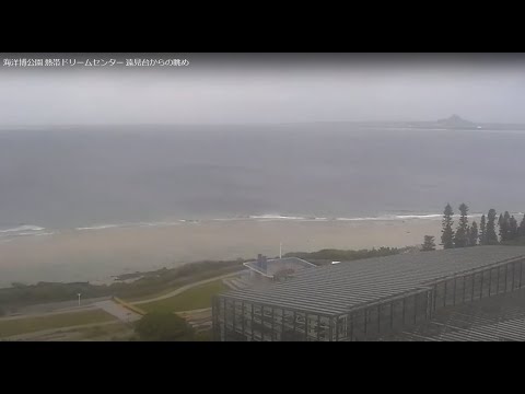
Ocean Expo Park's official camera shows the sea and surrounding scenery from the Tropical Dream Center lookout. It is in the park that contains Churaumi Aquarium, but does not show the aquarium interior. The marker is an approximate facility reference, not a verified camera mount. The thumbnail may differ from the current scene.
Aokawa Diving Service's official seaside camera shows the Sunabe and Miyagi coast. It offers a coastal view before a walk or diving trip, but is not a substitute for marine safety advice. The marker is an approximate facility reference, not a verified mount. The YouTube thumbnail may differ from the current scene.
Kansai TV News provides this official camera of Kansai International Airport Terminal 1, a gateway for trips to Osaka. Open the original YouTube broadcast to see the airport view. The marker is an approximate terminal reference, not a verified camera mount. The thumbnail is a representative broadcast image and may not show the current scene.
Oji Town's official summit cameras, linked by its tourism association, show different directions across the Nara basin and surrounding mountains through photographs updated about every ten minutes. They are not cameras installed at Horyuji or Mount Wakakusa. The marker is an approximate official summit reference; individual mounts are unverified.
Ryukyu Broadcasting provides this official Ishigaki Island camera, showing the port and town around the gateway to nearby islands. The marker is an approximate ferry-terminal area reference, not a verified filming building. The thumbnail is a representative image and may differ from the current scene.
Ryukyu Broadcasting's official Naha Airport camera shows aircraft and the airport scenery at Okinawa's main gateway. Open the original YouTube broadcast to view it. The marker is an approximate passenger-terminal reference, not a verified camera mount. The thumbnail may differ from the current scene; check flight information with your airline.
Okinawa Television's official Miyakojima camera shows the Painagama Beach and harbor area. The marker is an approximate facility reference around Hotel Atolle Emerald beside the beach; the exact mount is unverified. The thumbnail may differ from the current scene and does not establish swimming safety.
The Busena Terrace hotel provides this official beach camera overlooking the coast around Cape Busena in Nago. It is separate from the underwater observation tower camera. The marker is an approximate hotel facility reference, not a verified camera mount. The thumbnail is a representative image and may differ from the current scene.
Himeji Castle's management office provides this official camera of the admission gate area. It helps visitors see the entrance surroundings, rather than a panoramic view of the main keep. The marker is an approximate management-office reference beside the entrance, not a verified camera mount. Video playback is available only on the official website.
Kobe City's port bureau links this official Kobe Waterfront Development camera, showing Meriken Park, Port Tower and the waterfront cityscape. The marker is an approximate facility reference around the Meriken Park Oriental Hotel, not a verified camera mount. The thumbnail may differ from the current scene.
Kobe City's port bureau provides this official Harborland camera, showing the waterfront paths, bridge and cityscape around Hanekko Square. Although hosted on a disaster-prevention portal, its view is also useful for visitors exploring the waterfront. The marker is an approximate reference from the official camera map, not a verified mount. The thumbnail may differ from the current scene.
Wakayama Telecasting's official Koyasan camera shows the Danjo Garan area around Konpon Daito. Open the original YouTube broadcast to view it. The broadcaster may switch or suspend the view during maintenance or other operations. The marker is an approximate Danjo Garan reference, not a verified camera mount. The thumbnail is a representative broadcaster image and may not show the current scene.
Koya Town links this camera in front of the central information center from its official visitor map. It shows shops, pavements and buses in Koyasan's visitor center area. The marker uses the town's camera-map reference and is approximate, not a verified mount. The thumbnail may differ from the current scene.
Tottori Prefecture links camera 1 on its Sand Dunes Navi service. Photographs looking from the eastern side toward Umanose, the oasis area and the sea refresh about once a minute. This is an updating photo camera, not video. Select the Tottori Sand Dunes Navi link on the official information page to view the original HTTP-only viewer. We do not copy or relay its images. The marker is an approximate visitor-center area reference, not a verified mount.
Sanbe Tours, operated by Sanbe Development Corporation, provides this official camera from Yama no Eki Sanbe overlooking Nishinohara grassland. Its official page selects the channel's current live stream rather than a fixed video ID. The marker is an approximate facility reference, not a verified camera mount. Current broadcast status is not automatically confirmed.
NCC Nagasaki Culture Telecasting provides this official view of Sasebo Port, its surrounding city and hills. The marker follows an approximate camera-directory location; the installation building and exact mount remain unverified. This is not a view inside Huis Ten Bosch or of the Kujukushima islands. The YouTube thumbnail is a representative image, not a current frame; check the original for broadcast availability.
Hodosan Ropeway provides this official camera of the summit garden, hillside trees and walking paths. Use the live-camera button on the official page to open its external HTTP viewer. The marker is an approximate public camera-directory reference, not a verified mount. Image timing and continuous updates are not automatically confirmed.
Cable Media Shikoku provides this official camera overlooking Sunport Takamatsu, its passenger ferry piers and waterfront paths. The marker is an approximate reference near Takamatsu Symbol Tower, not a verified camera mount. The YouTube thumbnail is not guaranteed to show the latest scene; check the original for current broadcast availability.
Nagashima Spa Land's official attraction page links to this Weathernews camera. Updated photographs show the Aurora Ferris wheel and nearby roller coaster beyond trees. The marker is an approximate reference from the official attraction map, not a verified camera building or mount, and does not mean the camera is on the wheel. This is not Nabana no Sato or a hot-spring bath view. Check the original for image updates.
Gamagori Classic Hotel provides this official camera from the fifth floor of its main building. It overlooks Mikawa Bay, Gamagori's Takeshima island, its connecting bridge and the shore. The marker is an approximate hotel reference, not a verified mount. The YouTube thumbnail is not guaranteed to show the current scene; check the original for broadcast availability.
Ozu City's official camera overlooks Nagahama's red bridge, the river mouth, town and Iyo-nada from the observation park. The seasonal Hijikawa Arashi fog phenomenon depends on weather and is not guaranteed. The viewing direction may change; the marker is an approximate facility reference. Open the HTTP camera viewer from the official page.
Ozu City's official camera offers an elevated view over the town, Hijikawa River and surrounding hills from Tomisuyama Park. The view may change with camera direction; a close-up of Ozu Castle is not guaranteed. The marker uses the approximate park reference in the city's installation map, not a verified mount. Open the HTTP viewer from the official page.
Nihonkai TV provides this official Saigo Port camera from Oki View Port Hotel. It shows the ferry-port area at the gateway to the Oki Islands. The marker is an approximate hotel reference, not a verified mount. The YouTube thumbnail does not guarantee the current scene or ferry operation; check the original for current conditions.
Gungendo's official camera presents Hinaya, a traditional thatched house in Omori, and its natural surroundings. This is not a view inside the Iwami Ginzan mine tunnels. The marker uses the approximate Gungendo main-store reference in the official tourism listing; the exact mount is unverified. The YouTube thumbnail is an illustrated title card, not a current scene. Check the original for broadcast availability.
TSC TV Setouchi temporarily broadcasts the manatee tank at New Yashima Aquarium during its renovation closure. This camera does not mean the aquarium is open to visitors. It is separate from the temporary aquarium at the city market. The marker is an approximate reference for the original Yashima facility, not a verified tank-camera mount. The thumbnail is not guaranteed to show the current scene.
The MLIT Unzen Restoration Office provides this still-image camera from Iwatokoyama toward Mount Unzen, the upper Akamatsudani valley and lava dome. It offers a view of mountain clouds and visibility. The official page describes updates approximately every five minutes, but actual capture time and refresh are not guaranteed. The marker uses an approximate Iwatokoyama observation-site reference, not a verified camera mount. It is not guidance on access or hiking safety.
An official refreshing camera from Olivean Shodoshima Yuhigaoka Hotel overlooking the Seto Inland Sea, islands and sky. The marker is an approximate hotel reference, not a verified camera mount. This is not a camera inside Olive Park. The clock displayed in the source image may differ from the actual time.
Asago City provides this view of Takeda Castle Ruins. Its official schedule refreshes still images approximately every five minutes from 05:00 to 17:00 JST, retaining the 17:00 image afterward. Sea-of-clouds conditions depend on the weather. The marker is an approximate Ritsuunkyo-area reference across from the castle, not a verified installation point. The official page links to the original image over HTTP.
Chukyo TV's official news page provides this camera of the international apron at Chubu Centrair, a gateway to Nagoya. See aircraft and the airport surroundings. The marker is an approximate airport-facility reference, not a verified camera mount. The thumbnail may not show the current scene; consult airline information for flight status.
A camera overlooking Akagi Castle Ruins, linked by Kumano City and its tourism association. It shows the castle hill, surrounding mountains and local conditions such as mist. The marker is an approximate castle-area reference from the city's map, not a verified camera mount. The official page links to the original camera viewer over HTTP.
Hotel Matsushima Taikanso provides this official camera overlooking the islands and coast of Matsushima Bay, one of Japan's Three Scenic Views. The marker is an approximate hotel-area reference from its official map, not a verified camera mount. The YouTube thumbnail may not show the current scene.
An MLIT camera of the Okama crater surroundings linked by Zao Town's visitor information. Refreshing still images show mountain and cloud conditions. The marker is an approximate summit-observatory area reference from the official tourism map, not a verified camera mount. Fog or snow may obscure the view. Images do not establish hiking safety or route access. The official page links to an HTTP viewer.
Towada City's official camera shows the Yasumiya lakeside, with Lake Towada, surrounding hills and sightseeing boats. The marker is an approximate reference near the Yasumiya sightseeing-boat pier, not a verified camera mount. The official page links to an HTTP viewer. Images alone do not establish whether boat services are operating.
A camera from ABA Aomori Asahi Broadcasting's official channel overlooking the east plaza of Aomori Station, its urban surroundings and the Bay Bridge direction. The marker is an approximate station-front area reference, not a verified broadcaster camera mount. The YouTube thumbnail may not show the current scene.
A Mount Iwate camera operated by Fujimoto Laboratory at Iwate University's Faculty of Science and Engineering. Still images update every 30 minutes, showing the mountain and clouds beyond Morioka rather than continuous video. The marker is an approximate faculty campus reference from the official access map, not a verified mounting point. This is not a summit camera; check hiking safety separately.
A central-slope camera linked by Zao Chuo Ropeway, showing lifts and mountain scenery. The official page lists broadcasting hours of 06:00–18:00 Japan time. The marker is an approximate central-slope reference, not a verified mounting point. This is a different view from Juhyo Kogen Station; the YouTube thumbnail may not be current.
A City of Tsuruoka camera showing chidokan historic buildings and the town in periodically updated still images. The official page lists 04:00–20:30 operation and 15-minute updates, subject to delays or interruption. The marker is an approximate city-hall area reference, not a verified mounting point. Images are not reproduced here because the city prohibits unauthorized reproduction; use the official source link.
A City of Tsuruoka camera showing tsuruoka park and castle-site surroundings in periodically updated still images. The official page lists 04:00–20:30 operation and 15-minute updates, subject to delays or interruption. The marker is an approximate city-hall area reference, not a verified mounting point. Images are not reproduced here because the city prohibits unauthorized reproduction; use the official source link.
A Kobe Airport camera from Yomiuri TV's official news channel, linking to the original broadcast of the airport and aircraft movements. The marker is an approximate terminal-area reference, not a verified camera mount. The broadcast view may change or be interrupted; the thumbnail is a representative image rather than a current scene.
A Kurushima Strait camera linked by the Shimanami sightseeing-cruise operator, showing the sea, islands and bridge direction. The marker is an approximate company-office area reference identified by the camera listing, not the boarding pier or a verified mounting point. The official page links to an HTTP viewer; the camera view may change or become unavailable.
A City of Miyoshi camera showing Iya's Kazurabashi vine bridge and gorge. The marker is an approximate bridge-area reference, not a verified mounting point. Select ‘かずら橋’ in the official list. The operator requests no direct links to individual viewers, so the button opens its camera list; some original viewers use HTTP.
A City of Miyoshi camera showing vine bridges, woodland and gorge. Select ‘奥祖谷二重かずら橋’ in the official list. The operator requests no direct viewer links, so the button opens the list; some viewers use HTTP. The marker uses the prefecture's published camera-location reference approximately, not a verified current mounting point.
A City of Miyoshi camera showing yoshino river gorge and mountains. Select ‘小歩危展望台’ in the official list. The operator requests no direct viewer links, so the button opens the list; some viewers use HTTP. The marker uses the prefecture's published camera-location reference approximately, not a verified current mounting point.
A City of Miyoshi camera showing marshland and boardwalk. Select ‘黒沢湿原’ in the official list. The operator requests no direct viewer links, so the button opens the list; some viewers use HTTP. The marker uses the prefecture's published camera-location reference approximately, not a verified current mounting point.
A City of Miyoshi camera showing temple main hall and wooded grounds. Select ‘箸蔵寺 本殿’ in the official list. The operator requests no direct viewer links, so the button opens the list; some viewers use HTTP. The marker uses the prefecture's published camera-location reference approximately, not a verified current mounting point.
An Amakusa City camera showing ushibuka port and haiya bridge and the surrounding coast. The marker uses the city's camera-map reference approximately, not a verified mounting point. The official source provides updating still images; the view and availability may change.
An Amakusa City camera showing amakusa oniki west coast and the surrounding coast. The marker uses the city's camera-map reference approximately, not a verified mounting point. The official source provides updating still images; the view and availability may change.
A Hita City camera showing the river, park trees and surrounding town near Kizan Park. The city identifies the camera site as the Shode River promenade. The marker is an approximate park-area reference from the official map, not a verified mounting point or a Mameda historic-street camera. The official page links to the HTTP source image.
A Shimanto City camera overlooking Hirano Surf Beach, its waves and coastline. The marker uses an approximate beach reference from the official tourism listing, not a verified camera mounting point. Open the dedicated camera window on the city's page to reach the HTTP source. This is a coastal view, not a Shimanto River low-water bridge camera.
An Otsuki Town camera overlooking Kashiwajima port, the sea and the opposite shoreline. Select 柏島漁港 on the official page to open the source images. The marker is an approximate port-area reference, not a verified mounting point. This view does not guarantee a view of Kashiwajima Bridge or underwater scenery.
An official Niyodogawa Town camera showing Nakatsu Gorge Entrance, its water, rocks and surrounding trees through still images updated every ten minutes. Find 中津渓谷 on the official page. The marker uses an approximate gorge-area reference from the tourism association map, not a verified camera mounting point.
An official Niyodogawa Town camera showing Yasui Gorge, its water, rocks and surrounding trees through still images updated every ten minutes. Find 安居渓谷 on the official page. The marker uses an approximate gorge-area reference from the tourism association map, not a verified camera mounting point.
A Niyodogawa Town camera showing the Hyotan cherry tree area and nearby path in still images updated every ten minutes. The cherry-blossom category describes the seasonal attraction, not current blooming. The marker uses an approximate tourism-map reference, not a verified mounting point. Find ひょうたん桜 on the official page.
An Imari Cable Television camera showing a stream, footbridge, trees and walking area at Okawachiyama. The broadcaster describes image updates approximately every 20 seconds. The marker uses an approximate area reference from a camera-directory map, not a verified mounting point. This is not a panorama of the entire pottery village.
An official JB Highway Service camera looking toward Akashi Kaikyo Bridge and the strait from the inbound Awaji Service Area. The marker is an approximate service-area reference, not a verified camera mounting point. The YouTube preview does not guarantee the current scene.
A Hakone Tourist Association camera covering the road and pedestrian approach near Yumoto Station, a gateway to the hot-spring area. It does not show bathing areas or the entire onsen town. The marker approximates the area around the tourism products museum; the exact mounting point is unverified.
A Dankazura camera linked by Toshimaya, a Kamakura souvenir shop, on its official website. It shows the approach, second torii and tree-lined surroundings, not the shrine interior. The marker uses the surrounding-area reference from the official main-store map, not an exact building or camera mounting point.
Periodically updated JMA images show Owakudani's volcanic landscape and visibility. This is not continuous video, and fog or steam may obscure the view. Check official volcanic alerts and access restrictions before visiting.
An official Miyagi Television camera overlooking Sendai Station's western forecourt, pedestrian decks and surrounding cityscape. The map marks the approximate filming-facility area, not an exact mounting point.
An official khb Higashinippon Broadcasting camera overlooking Sendai Station's western forecourt, pedestrian decks and surrounding cityscape. The map marks the approximate filming-facility area, not an exact mounting point.
A view toward Mount Hakkoda from JMA's Jigokunuma station near Sukayu Onsen. These are periodically updated still images, not continuous video or a view inside the hot spring. Check official volcanic alerts and local access information before visiting.
A periodically updated camera looking toward Mount Hakkoda from ABA's headquarters in Aomori. It is not installed on the mountain; at night or in poor weather, only nearby city lights may be visible.
An official ABS camera overlooking Akita Station's western forecourt, pedestrian passage and surrounding cityscape. The marker is an approximate reference near the broadcaster's headquarters, not the exact rooftop mounting point.
An official IAT camera overlooking Morioka's cityscape and sky. Views vary with camera direction and weather. The marker approximates the broadcaster's headquarters west of Morioka Station; this is not a dedicated station-plaza view.
Periodically refreshed lakeside images provided by the Urabandai Tourism Association. The lake and surrounding mountains may be difficult to see at night or in poor weather. The marker approximates the area near Hibara History Museum identified in the camera listing, not the exact mounting point.
Periodically refreshed Mount Nasu images from a Tochigi Prefecture camera, published by MLIT's Nikko Sabo Office. The marker approximates the Nasu Ropeway base-station area, not the exact mount. Mountains may be obscured at night or in fog. Consult official weather and access restrictions before hiking.
Periodically refreshed images of the slopes in front of Naeba's base hotel, linked by the resort's official website. Images are approximately 15 minutes apart and may appear monochrome at night. The marker uses the provider's facility-area coordinates and may differ from the exact camera mount.
The Media Ship operator's north-facing camera from its 20th-floor observation area, overlooking the Shinano River mouth and harbour toward Toki Messe. The marker approximates the facility using its official access map, not the exact camera mount. Check the official stream for current broadcast availability.
Ishikawa Prefecture's camera showing the water of Lake Shibayamagata near Katayamazu Onsen. The official page provides periodically updated still images rather than continuous video. Visibility is limited at night; this is a lake view, not a view inside a hot spring or of the entire resort town. The marker approximates the observation area indicated by the public river map, not a surveyed camera mount.
MRO Hokuriku Broadcasting's Murodo mountain camera, linked by the Hakusan Tourism Association. It offers a mountain view around this climbing base. Broadcasting is seasonal; the current stream title announces a planned stop on October 13. Check the original for current availability. The marker uses the official tourism listing's approximate Murodo facility location, not the exact camera mount.
HAB Hokuriku Asahi Broadcasting's view around Wajima Harbour, showing the waterfront and nearby town. It does not establish whether the morning market is operating. The marker approximates the harbour-side location indicated by the camera directory map, not a surveyed camera mount. Check the official original for current broadcast availability.
Shirono Hotel Kofu's camera overlooking Kofu Castle's keep platform, stone walls and the surrounding town at Maizuru Castle Park. The marker approximates the filming hotel's location, not a camera inside the castle or a surveyed mount. Check the official original for current broadcast availability.
Lake Shojiko camera provided by Kawaguchiko Cable TV and linked by Fujikawaguchiko Town. The official page provides five-minute still-image updates looking over the lake toward Mount Fuji. The marker approximates the Shojiko Tourism Association area based on camera-location guidance, not the exact mount. Original images are not reused here because secondary use is restricted.
Shimosuwa Tourism's camera overlooking Lake Suwa toward Mount Fuji, with the lakeside park and surrounding mountains. Fuji may be obscured by weather or clouds. The marker approximates the Mizube Park area rather than the exact camera mount. Check the official original for current broadcast availability.
Periodically updated official photograph of the Hikage slopes at Nozawa Onsen Ski Resort, also used by the summer sports park. The view may be dark at night because lighting is limited. The marker uses an approximate sports-park location from its official access map, not the exact camera mount. This is a slope view, not a camera inside a hot-spring bath.
An official NKT camera overlooking Yonago Station and the Gaina Road pedestrian passage, a gateway for trips around the Sanin region. The marker uses the approximate location of Yonago Washington Hotel Plaza, identified as the filming facility, rather than the exact camera mount.
An official KKT fixed-point camera in Hitoyoshi overlooking the Kuma River, Ohashi Bridge, Nakagawara Park and surrounding townscape. The marker is an approximate reference in Kokonokamachi, the reported filming area, not a verified building or exact camera mount. This is not a camera inside Hitoyoshi Castle.
An official coastal camera from regional internet broadcaster NichinanTV, showing the Hirowatari River mouth, bridge and Pacific Ocean, with a road also in view. The marker uses the approximate area shown on Hotel Season Nichinan's official access map, the reported filming facility, not an exact camera mount. This camera is not at Aoshima or Udo Shrine.
An official peacock camera at Kurume Bird Center, operated by the city's urban park management foundation. It shows a bird exhibit within Chuo Park; animals may not always be visible. The marker uses the center's approximate surroundings from its official access map, not the exact camera mount in the enclosure.
A sunflower-field camera provided by the Yanagawa tourism association. Choose '開花状況' (bloom conditions) on the official page. The announced 2026 garden season is September 4–13; outside the season the feed may stop or show no flowers. The marker uses an approximate garden-area reference from the official tourism map, not an exact camera mount. This is separate from the canal boat tours and the parking cameras.
Kushimoto Town's public camera provides a town panorama from near Umasaka viewpoint. It is useful for viewing the coastal town; after dark, mainly town lights are visible. This is an updating photograph, without a guaranteed capture timestamp or clear view. The marker is an approximate reference for Umasaka Park, not the exact camera mount. This is separate from the Shionomisaki Lighthouse camera.
Updating observation photographs of Noboribetsu's Jigokudani Valley from the Japan Meteorological Agency. The camera shows volcanic terrain and steam beside the hot-spring town; steam, clouds and darkness may limit visibility. This is not continuous video, and visitors should check local official access information. The marker uses an approximate location converted from JMA's rounded observation-point coordinates. This is separate from the snow-monkey park in Nagano.
Rusutsu Resort's official West Mountain cameras provide updating photographs towards the resort, Lake Toya and Mount Yotei. Choose the view on the official page. At night mainly town lights may be visible, with mountains and the lake obscured. The marker uses the approximate Yotei Panorama Terrace area at the West Mountain summit, not each camera's exact mount. These cameras are not installed on the Lake Toya shore or Mount Yotei's summit.
YBS Yamanashi Broadcasting's Lake Motosu and Mount Fuji camera, recommended by Minobu Town. It looks towards Mount Fuji from around the Nakanokura Pass viewpoint northwest of the lake. The marker is an approximate viewpoint-area reference, not an exact camera mount. Weather and darkness may obscure the lake or mountain. The link opens the broadcaster's official YouTube camera, not the discontinued municipal photograph service.
A rooftop seaview camera at Rausu's observation tower, linked by Rausu Town. From above the town it looks out to sea towards Kunashir Island, which may be obscured by weather or darkness. The marker uses an approximate tower-area reference matching the official facility address, not the exact camera mount. The original opens on YouTube through the Northern Territories Issue Association's official camera service.
An officially linked camera at Busshoike Hut near Mount Gassan's ninth station. The original offers photographs of the hut surroundings and the snowfield direction. This seasonal service provides updating still images; weather or communications may delay updates, and darkness can obscure the terrain. Snow is not always present. The marker uses an approximate hut-area reference from Yamagata's official tourism map, not the summit or the eighth-station parking area.
Yutaki Rest House's waterfall camera, listed by the Nikko tourism association. On the official list, choose the details link for '湯滝' to open the original photographs. Images update about every 15 minutes; the falls may be difficult to see at night. The operator uses a legacy HTTP page, so your browser may show a security notice. The marker uses the approximate rest-house area below the falls, not the exact camera mount.
An official Toyama Bay mirage-observation camera from Uozu Buried Forest Museum, looking from the Uozu coast towards Iwase in Toyama City. Mirages depend on weather and season and are not always visible; at night only distant coastal lights may be seen. Broadcasts restart in separate sessions, so the link opens the official channel's current live page. The museum's original page also offers views towards Imizu and Kurobe. The marker is an approximate museum-area reference, not an exact camera mount.
A Shirahama Ohama Beach camera provided by Shimoda City's Tourism Exchange Division and the tourism association's LIVE SHIMODA service. It overlooks the sandy coast south of Shirahama Shrine, separate from Shirahama Chuo Beach to the north. The view may be dark at night, and maintenance can change the broadcast URL. Check the association's daily guidance for swimming conditions rather than relying on the camera. The marker is an approximate beach-area reference, not an exact camera mount.
LIVE SHIMODA's Sotoura Beach camera, provided with filming cooperation from Shimoda View Hotel. The official view looks down towards the bay and beach from the hillside. Darkness or bad weather may obscure the coast; the camera is not a safety assessment for swimming or other water activities. The marker represents the filming hotel's approximate location, not the exact camera mount.
An official LIVE SHIMODA camera from Shimoda City's Tourism Exchange Division and tourism association, looking towards Cape Tsumekizaki's bay and coastal park from the parking-area vicinity. The area is known for winter narcissus, but flowers or any particular view are not guaranteed. Most of the image can be dark at night. The marker is an approximate parking-area reference and does not imply a camera mounted on the lighthouse.
An official TSK San-in Chuo Television camera looking from its headquarters towards central Matsue. See the river crossing and the city towards the station. Its filming position differs from the Shinji-ko Bridge camera; it is not a dedicated view of Matsue Castle or Lake Shinji's sunset. The marker is an approximate reference for the broadcaster's headquarters.
HOME Hiroshima News' official view of Hondori Crossing, showing the entrance to Hondori shopping street and the tram-stop area. It is useful for planning a walk around central Hiroshima, not a dedicated view inside Peace Memorial Park or of Hiroshima Castle. The map uses an approximate camera-area reference in Kamiyacho 2-chome rather than an exact mounting point.
An official tys Television Yamaguchi camera from Kaikyo Messe Shimonoseki, looking towards Kanmon Bridge, the strait and Shimonoseki's waterfront. It does not show the interior of Karato Market or the aquarium. The marker is an approximate reference for the Kaikyo Messe facility; broadcasts may be interrupted and the viewing direction can change.
Television Ehime's official camera from the Kurushima Strait Observatory, overlooking the bridges, islands and strait along the Shimanami Kaido. It can help visitors preview the scenery before a sightseeing or cycling trip. The marker uses the observatory facility reference in Itoyama Park rather than an exact mounting point. Broadcasts may be interrupted and the view can change.
An official eat Ehime Asahi Television camera from Kirosan Observatory Park on Oshima, looking across the Kurushima Kaikyo bridges and Seto Inland Sea islands. This elevated island-side view differs from the observatory camera south of the strait. Little beyond lights may be visible at night. The map marks the approximate park facility, not the exact camera mount.
An official Television Ehime camera using footage supplied by Uwajima Cable Television. From City Hall it looks towards the harbor and waterfront cityscape, useful for previewing the area before a harbor walk or a visit to Uwajima. Main roads are also visible; this is not an interior or dedicated keep view of Uwajima Castle. The marker is an approximate reference for City Hall, the camera facility.
Television Ehime's official camera from Shokenyama Park in Ainan, overlooking Misho Bay, surrounding hills and coastal settlements. It offers a preview of the scenery for an Ainan coastal trip, not a continuous close-up of the park's plum grove or rides. The map uses the park reference from the official tourism map; the actual camera mounting point may differ.
Mima City's official camera of the historic Udatsu streetscape by Yoshida Residence. On the official page, choose ‘うだつの町並み②’ for the tiled buildings and street view. Rain and night lighting can blur parts of the picture. The marker uses an approximate street reference from the city's official visitor guide, not an exact building-mounted camera position.
KBN's official camera looks towards Seto Ohashi Bridge and the Seto Inland Sea from the Shottsujiyama observatory area in Utazu. Since broadcast addresses can change, the link opens KBN's official YouTube live listing; choose the Seto Ohashi camera there. The marker is an approximate reference for the observatory facility, not the exact camera mount. On-air status is not automatically confirmed.
Nagasaki Cable Media's official camera looks towards Gunkanjima (Hashima), the World Heritage island, from Nagasaki City Dinosaur Museum on the Nomozaki coast. The image can be nearly dark at night because there is little surrounding light. Weather, maintenance, or the limited-period feed can interrupt or change the broadcast. The marker is an approximate reference for the dinosaur museum, the camera facility—not Gunkanjima itself or an exact rooftop mount.
Tarumizu City’s official live camera looks towards Sakurajima from the city hall. The public viewer identifies a Home preset for the full Sakurajima view across Kinko Bay and a Kako preset for a closer crater view. Weather and night conditions can make the image dark or limit visibility. The marker is an approximate reference for Tarumizu City Hall, not the exact camera mount.
Look across Lake Tofutsu toward Mount Shari from the Waterfowl and Wetland Center. The view takes in the lakeside sky and the wetland landscape through the seasons.
Look out over Lake Kussharo from the Gurutto Panorama roadside station at Bihoro Pass. Periodically updated images show mist over the lake and seasonal changes in the surrounding mountains.
Explore the view across the Sarobetsu wetlands from the Wetland Center. Take a look at the sky and the wetland's seasonal colors before a boardwalk visit.
See the lakeshore from the Lake Kutcharo Waterfowl Observatory in Hamatonbetsu. Migrating birds stop here in spring and autumn, and both bird activity and the scenery change with the seasons.
Take in Lake Towada from Hakka Pass Observatory in Kosaka, Akita. The view includes the lake and the changing seasonal colors of the surrounding forest.
Look out to sea from Cape Soya Lighthouse at the northern tip of Hokkaido. Open the Japan Coast Guard camera page to see the sea and sky around the cape.
See the sea and sky around Cape Erimo from its lighthouse. Open the Japan Coast Guard camera page for a look at the cape before a trip along the Hidaka coast.
Look out over the sea from Cape Nosappu Lighthouse in Nemuro, a popular sunrise destination. Visibility and the view change with the weather and time of day.
Look out to sea from Cape Tappi Lighthouse near the northern tip of the Tsugaru Peninsula. Take a look before visiting the cape or its stairway national road.
See the coast at the northeastern edge of the Shimokita Peninsula from Shiriyazaki Lighthouse. Take a look before visiting the lighthouse and the surrounding cape.
See Mount Karasugasen and the surrounding highlands from Kagamiganaru in Daisen. Open the Ministry of the Environment's camera page to view its images.
Look out over the Seto Inland Sea and its islands from Mount Washuzan. The Ministry of the Environment provides the camera images on its official page.
Explore the Northern Alps and summit terrace surroundings through Hakuba Iwatake Mountain Harbor's panoramic camera. Open the original for the wide mountain view.
Look toward Mount Asahidake from the ropeway's Sugatami Station. The official camera offers a view of the mountain through the seasons, from lingering snow to autumn colors.
See the base area at Niseko Annupuri International Ski Area. The view shows the winter snowscape and the area around the sightseeing gondola in summer.
See the changing seasons at the base of Sapporo Kokusai Ski Resort. The camera covers the winter ski area and the forest around the autumn sightseeing gondola.
Look down on Hakodate, with the sea on both sides of the city, from the summit observatory. The ropeway's official camera offers daytime views and the city nightscape.
See the mountains and resort from the upper station of Hakuba Happo's Alpen Quad lift. This view offers a different vantage point from the Usagidaira and gondola base cameras.
See the surroundings of Hakuba Happo's gondola base and the mountains beyond. Compare it with the upper-station camera for another perspective on the resort.
See the surroundings of the upper ropeway station serving Tsugaike Nature Park. Check the camera image and its timestamp when planning a highland walk.
Look toward the Southern Alps from Hotel Senjojiki. Pair this view with the hotel's cirque-facing camera to see the mountains in two different directions.
See Kappa Bridge and the Hotaka mountains through Gosenjaku Hotel's official camera in Kamikochi. The hotel lists it as a 24-hour camera; check the source for stream availability.
Look across larch woodland toward the Hotaka mountains from Kamikochi Bus Terminal. View the scene through the Natural Parks Foundation's official camera.
See Mount Fuji from the roof of Shizuoka's Mount Fuji World Heritage Centre. The source provides still images roughly every ten minutes rather than continuous video, so check the image timestamp.
See Mount Fuji and the surrounding landscape from Nihondaira Yume Terrace. The observatory lists this as a 24-hour live camera; check the source for stream availability.
See Mount Fuji in still images from Fujinomiya City Hall. The city's official camera page lets you compare the latest image with others taken earlier the same day.
See Mount Fuji from First Terrace at FUJIYAMA Twin Terrace on Shindo Pass. Still images usually update every thirty minutes during daylight hours, so check when each image was taken.
Look toward the Tateyama range from Toyama City Hall's observation tower. Choose the east- or south-facing camera on the official page to compare the views.
See the mountain scenery around Higashidateyama's upper gondola station in Shiga Kogen. The tourism association's official page carries the resort operator's camera.
See the high-alpine scenery from Yarigatake Sanso, the hut below Yarigatake's summit. Weather and seasonal closures can interrupt image updates, so check the timestamp.
See the Northern Alps around Minamidake Hut. If you use the image for trip planning, check its timestamp alongside a separate mountain weather forecast.
See the mountain scenery from Dakesawa Hut above Kamikochi. When planning a hike, check the original image timestamp alongside local mountain weather information.
Look toward Karasawa through Hotakadake Sanso's east-facing camera. Choose this view rather than the west-facing camera if you want to see the Karasawa side.
Look toward Shiradashizawa in Gifu through Hotakadake Sanso's west-facing camera. It shows the opposite side of the hut from the east-facing Karasawa camera.
See the forest and rural landscape from Kyororo observation tower in Matsunoyama. Tokamachi City publishes still images at roughly fifteen-minute intervals; check the timestamp on the original.
Look across Lake Yamanaka toward Mount Fuji from Community Plaza Kirara. Choose the wide-angle or telephoto image on the official page to compare the broader lake view with a closer perspective.
See a panorama of Sapporo from the rooftop-tower camera at STV's headquarters. Its direction may change for broadcasting or weather conditions, so check the official page for the view being shown.
Watch the official live view toward Mount Fuji from Oshino Shinobi no Sato ninja village. Take a look at the mountain and sky before exploring the Oshino Hakkai area.
See Mount Fuji and the Shinnasho River surroundings from Omiyabashi Bridge in Oshino. Open the village's official camera page to view the still image and its timestamp.
See Oshino village and Mount Fuji together from the SORA no IRO viewing terrace on Nijumagari Pass. Open the village's official live camera for the view across the settlement toward the mountain.
See the reception area at the Fifth Station General Management Center on Mount Fuji's Yoshida Route. Yamanashi Prefecture operates this seasonal camera during the climbing season; check the source for stream availability.

 External preview restricted